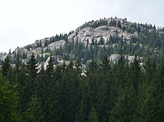
Category:Ohnište
| Upload media | |||||
| Instance of | |||||
|---|---|---|---|---|---|
| Located in protected area | |||||
| Location |
| ||||
| Mountain range | |||||
| Elevation above sea level |
| ||||
 | |||||
Subcategories
This category has the following 2 subcategories, out of 2 total.
O
- Okno (Ohnište) (6 F)
V
- Veľká ľadová priepasť (6 F)
Media in category "Ohnište"
The following 13 files are in this category, out of 13 total.
-
Bralá Ohnišťa - panoramio.jpg 3,968 × 2,976; 7.42 MB
-
Cesta ku skalnému oku - panoramio.jpg 3,968 × 2,976; 6.84 MB
-
Neznačené chodníky pod Ohnišťom - panoramio.jpg 2,976 × 3,968; 6.66 MB
-
Ohniste.jpg 2,048 × 1,536; 1.03 MB
-
Ohnište - panoramio.jpg 3,968 × 2,976; 6.83 MB
-
Ohnište 01.JPG 3,968 × 2,976; 4.99 MB
-
Ohnište 02.JPG 3,968 × 2,976; 3.54 MB
-
Ohnište 04.JPG 3,968 × 2,976; 5.43 MB
-
Ohnište 05.JPG 3,968 × 2,976; 4.01 MB
-
Ohnište 06.JPG 3,968 × 2,976; 3.38 MB
-
Ohnište, výhľad na Ďumbier.JPG 3,968 × 2,976; 3.39 MB
-
Oktobrove Tatry - panoramio.jpg 3,968 × 2,976; 7.57 MB
-
Skalné terasy - panoramio.jpg 3,968 × 2,976; 5.01 MB


