Category:Old City Hall (Kungur)
| Object location | | View all coordinates using: OpenStreetMap |
|---|
This is a category about a cultural heritage object in Russia, number: 5900158000
| |
| This template and pages using it are maintained by the Russian WLM team. Please read the guidelines before making any changes that can affect the monuments database! |
building of Kungur, Russia  | |||||
| Upload media | |||||
| Instance of | |||||
|---|---|---|---|---|---|
| Location | Kungur, Perm Krai, Russia | ||||
| Heritage designation | |||||
 | |||||
Media in category "Old City Hall (Kungur)"
The following 11 files are in this category, out of 11 total.
-
 Cathedral Square (Kungur)-1.jpg 6,000 × 4,000; 14.36 MB
-
 Kungur asv2019-05 img69 Cathedral Square.jpg 5,223 × 3,917; 8.54 MB
-
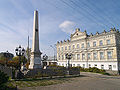 Obelisk from armies Pugachev.jpg 800 × 600; 495 KB
-
 St Alexis church in Kungur.jpg 1,431 × 1,112; 1.14 MB
-
 Городская управа Кунгур.JPG 4,000 × 3,000; 2.43 MB
-
 Гостинный двор1.jpg 1,280 × 960; 466 KB
-
 Кунгур 2008 (0002).jpg 3,612 × 2,484; 6.66 MB
-
 Кунгурская городская управа, улица Карла Маркса, 3, Кунгур, Пермский край.jpg 3,232 × 1,903; 1.2 MB
-
 Кунгурская городская управа.jpg 2,285 × 1,714; 419 KB
-
 Куунгур управа.jpg 4,608 × 2,592; 4.22 MB
-
 Малая Алексеевская церковь.jpg 4,423 × 2,154; 6.87 MB
-1.jpg)


.jpg)


