Category:Old Russian nautical charts
Subcategories
This category has only the following subcategory.
A
- Atlas of the Baltic Sea 1757 (30 F)
Media in category "Old Russian nautical charts"
The following 9 files are in this category, out of 9 total.
-
 1829 map of the Black Sea by the Russian Hydrographic Depot.jpg 23,269 × 15,246; 57.55 MB
-
 1869 Russian nautical chart of the Gulf of Riga.jpg 15,579 × 23,586; 86.51 MB
-
 19th century - Russian nautical chart of the Black Sea.jpg 11,687 × 7,834; 7.81 MB
-
 Osa Suomenlahtea L Spafarjev 1823.jpg 1,200 × 770; 163 KB
-
 Ost-See, XVII.jpg 896 × 800; 302 KB
-
 Rysk karta av Biskopsö.jpg 3,264 × 2,448; 989 KB
-
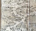 Rysk karta av Nagu centrum.jpg 2,724 × 2,380; 803 KB
-
 Sjøkart over Novaja Semlja og Karahavet, fra1897.png 3,063 × 4,037; 22.14 MB
-
 Карта Азовского моря (1833).jpg 8,873 × 5,964; 1.4 MB


.jpg)