Category:Old cartoon maps of Europe
Media in category "Old cartoon maps of Europe"
The following 15 files are in this category, out of 15 total.
-

-
 Carte des états désunis d'Europe - Kungliga Biblioteket - 10348540.tif 10,307 × 7,703, 2 pages; 454.33 MB
-
 Carte drôlatique d'Europe pour 1870.jpg 5,287 × 4,231; 5.28 MB
-
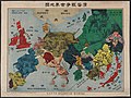
 Cartoon map of world war 1.jpg 300 × 208; 17 KB
-
 Fred. W. Rose The Avenger An Allegorical War Map for 1877 1877 Cornell CUL PJM 1080 01.jpg 9,002 × 7,137; 12.83 MB
-
 John Bull and his Friends 1900.jpg 8,439 × 5,943; 15.22 MB
-
 Latest war map of Europe - as seen through French eyes LOC 2010587001.jpg 5,300 × 3,958; 3.23 MB
-
 Latest war map of Europe - as seen through French eyes LOC 2010587001.tif 5,300 × 3,958; 60.02 MB
-
 Pictorial map of World War I in Russian.jpg 7,308 × 5,505; 14.99 MB
-
 Politische Charte von Europa, 1848.jpg 4,340 × 3,153; 3.81 MB
-
 Rusofob pic8.jpg 600 × 442; 48 KB
-
 Satirical Europe in 1870.jpg 1,119 × 715; 265 KB
-
 Satirical Map of Europe, 1887.jpg 1,479 × 921; 369 KB
-
 Satirical map of Europe, 1914.jpg 1,525 × 1,117; 332 KB
-
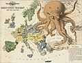 Serio-comic war map for 1877.jpg 8,440 × 6,448; 13.21 MB
.jpg)


