Category:Old maps of Albany, New York
Subcategories
This category has only the following subcategory.
Media in category "Old maps of Albany, New York"
The following 56 files are in this category, out of 56 total.
-
 Castle Island and Fort Orange Albany, New York 1629.jpg 200 × 147; 16 KB
-
 Fort Orange in c1630 Rensselaerswyck Map Detail (now Albany NY).png 1,100 × 670; 1.25 MB
-
 Albany Stockades.png 1,501 × 1,159; 598 KB
-
 207 of 'The Annals of Albany. By Joel Munsell' (11032091674).jpg 1,927 × 1,168; 289 KB
-
 99 of 'The Settlement and Early History of Albany' (11065754184).jpg 1,928 × 1,408; 303 KB
-
 10 of 'The Settlement and Early History of Albany' (11240635735).jpg 1,318 × 1,565; 410 KB
-
 142 of 'The Annals of Albany. By Joel Munsell' (11032294246).jpg 1,193 × 1,622; 484 KB
-
 297 of 'The Annals of Albany. By Joel Munsell' (11011096704).jpg 946 × 782; 198 KB
-
 53 of 'American Historic Towns' (11292203306).jpg 1,132 × 1,550; 479 KB
-
 Albany plan 1695.png 1,167 × 1,390; 820 KB
-
 FortAlbany.jpg 300 × 229; 20 KB
-
 Albanymapmiller1695.jpg 581 × 475; 88 KB
-
 105 of 'The Settlement and Early History of Albany' (11047533083).jpg 915 × 703; 171 KB
-
 1758albany.jpg 350 × 234; 98 KB
-
 8 of 'The Annals of Albany. By Joel Munsell' (11032388583).jpg 4,147 × 2,456; 1.46 MB
-
 8 of 'The Annals of Albany. By Joel Munsell' (11034223144).jpg 6,487 × 4,626; 4.48 MB
-
 7 of 'The Annals of Albany. By Joel Munsell' (11034333213).jpg 3,844 × 2,888; 1.6 MB
-
 DeWittmapofAlbany1790.jpg 600 × 540; 127 KB
-
 292 of 'The Annals of Albany. By Joel Munsell' (11034754066).jpg 1,191 × 2,096; 465 KB
-
 Albany1794.jpg 1,000 × 1,265; 543 KB
-
 AlbanyPastures1794.png 425 × 311; 183 KB
-
 1820 Yates Map of Albany circa 1770 - Geographicus - Albany-yates-1820.jpg 3,000 × 2,081; 961 KB
-
 Albany-1829-b.jpg 370 × 465; 34 KB
-

-
 145 of 'The Annals of Albany. By Joel Munsell' (11229841245).jpg 1,193 × 1,602; 736 KB
-
 Albany, N.Y LCCN2004667238.jpg 1,024 × 701; 113 KB
-
 1857 Map of Albany.jpeg 3,000 × 3,947; 5.14 MB
-
 Albany Basin 1857.jpeg 1,035 × 718; 865 KB
-
 1857 Map of Albany Edit Crop.jpeg 408 × 742; 236 KB
-
 1857 Map of Albany Edit.jpeg 2,955 × 3,862; 7.8 MB
-
 NorthAlbany1866.jpg 420 × 400; 36 KB
-
 Lithograph of Albany New York in 1879.jpg 4,000 × 2,723; 1.87 MB
-
 HurstvilleNY.jpg 420 × 400; 39 KB
-
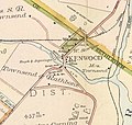 KenwoodNYmap.jpg 420 × 400; 37 KB
-
 NormansvilleNY.jpg 420 × 400; 29 KB
-
 NorthAlbany1891.jpg 420 × 400; 50 KB
-
 WashingtonParkAlbany1891.jpeg 1,200 × 759; 189 KB
-
 Albany New York 1895 Restored.jpg 6,857 × 4,808; 21.28 MB
-
 Albany New York 1895.jpg 7,904 × 6,438; 7.46 MB
-
 1950 port of albany.jpg 1,814 × 3,160; 950 KB
-
 Albany Bleecker Stadium.jpeg 435 × 331; 156 KB
-
 Albany Lumber District.jpg 760 × 497; 75 KB
-
 Albany Yellow Book cropped.jpeg 685 × 593; 179 KB
-
 Albany, New York 1955 Yellow Book.jpg 800 × 1,058; 246 KB
-
 Albanyplaza.jpg 550 × 338; 42 KB
-
 BeaverParkAlbany1876.jpg 420 × 400; 41 KB
-
 Downtown1878.jpg 760 × 517; 97 KB
-
 Map of Rensselaers Wyck Anno 1630 with Fort Orange.jpg 8,345 × 2,983; 10.34 MB
-
 Map of the city of Albany (8347361684).jpg 800 × 531; 96 KB
-
 NY 43 former routing map late 1940s.png 1,601 × 843; 3.13 MB
-
 Outline and Index NYPL1575825.tiff 7,108 × 4,822; 98.06 MB
-
 Pastures4th WardAlbanyNY.jpg 760 × 512; 82 KB
-
 Route of the Albany and West Stockbridge Rail Road, 1842. NYPL434063.tiff 4,632 × 6,011; 79.66 MB
-
 WashingtonPark1876.jpg 420 × 400; 32 KB
-
 WashingtonParkcemetery.jpg 252 × 425; 21 KB
-
 Westerlo Island in 1893.jpg 178 × 529; 45 KB

.png)

.jpg)
.jpg)
.jpg)
.jpg)
.jpg)
.jpg)


.jpg)

.jpg)
.jpg)
.jpg)

.jpg)


.jpg)


.jpg)


