Category:Old maps of Amazonas (Venezuela)
Subcategories
This category has only the following subcategory.
Media in category "Old maps of Amazonas (Venezuela)"
The following 3 files are in this category, out of 3 total.
-
 Carta del Departamento del Orinoco.jpg 7,353 × 5,065; 14.88 MB
-
 Estado Amazonas - SAGECAN 1994.jpg 2,598 × 3,738; 10.53 MB
-
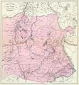 Provincia de Guayana Cantón Rionegro.JPG 1,856 × 2,009; 920 KB


