Category:Old maps of Amt Creuzburg
Deutsch: Diese Kategorie umfasst Karten von Amt Creuzburg, die über 70 Jahre alt sind. Für jüngere Karten siehe die Category:Maps of Amt Creuzburg
Media in category "Old maps of Amt Creuzburg"
The following 11 files are in this category, out of 11 total.
-
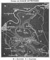
 Reilly 371.jpg 1,610 × 1,319; 498 KB
-
 Karte zur Studie der Thyphusepedemie 1865 in Ütteroda und Madelungen..png 1,136 × 1,350; 2.25 MB
-
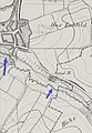 Lauterbach (Werra) Abschnitt 4.jpg 420 × 609; 171 KB
-
 Lauterbach (Werra) Abschnitt 5 Mündung.jpg 456 × 567; 144 KB
-
 Werra Abschnitt Buchenau Ebenau.jpg 1,250 × 1,173; 992 KB
-
 Werra Abschnitt Creuzburg.jpg 1,462 × 1,384; 1.23 MB
-
 Werra Abschnitt Ebenshausen.jpg 1,066 × 758; 518 KB
-
 Werra Abschnitt Falken und Probsteizella.jpg 2,150 × 1,051; 1.52 MB
-
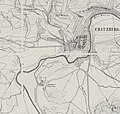
 Werra Abschnitt Frankenroda.jpg 1,546 × 697; 708 KB
-
 Werra Abschnitt Mihla mit Freitagszella.jpg 1,456 × 1,518; 1.33 MB
-
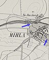
 Werra Abschnitt Mihla östlicher Teil.jpg 529 × 1,152; 414 KB


_Abschnitt_4.jpg)
_Abschnitt_5_M%C3%BCndung.jpg)


