Category:Old maps of Anglesey
Subcategories
This category has the following 2 subcategories, out of 2 total.
Media in category "Old maps of Anglesey"
The following 26 files are in this category, out of 26 total.
-

-

-
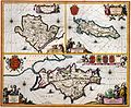
 Mona Insula Vulgo Anglesey - btv1b53056254f (1 of 2).jpg 3,496 × 2,896; 1.59 MB
-
-
 UBBasel Map Isle of Man Anglesey 1685-1686 Kartenslg Mappe 238-17.tif 2,856 × 4,548, 2 pages; 37.19 MB
-
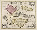 Mona insula vulgo Anglesey ; Mona insula vulgo The isle of... - CBT 6599408.jpg 5,738 × 4,738; 7.52 MB
-
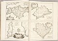 Atlante Veneto Volume 2 014.jpg 10,325 × 7,312; 7.18 MB
-
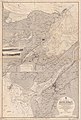
 Ordnance Survey Drawings - Holyhead (OSD 317).jpg 5,739 × 3,403; 3.15 MB
-
 Ordnance Survey Drawings - Llangefni (OSD 318).jpg 5,833 × 3,246; 2.48 MB
-
 Ordnance Survey Drawings - Conway (OSD 312).jpg 5,716 × 3,197; 3.33 MB
-
 91 of 'England and Wales Delineated, etc' (11034257696).jpg 1,519 × 2,431; 828 KB
-
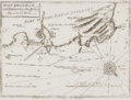
 A plan of Dulas Bay and harbour in ye north of Anglesey.gif 1,000 × 741; 189 KB
-
 Admiralty Chart No 1464 Menai Strait Wales, Published 1894.jpg 8,192 × 12,112; 20.53 MB
-
 Admiralty Chart No 368 Wales Barmouth to South Stack, Published 1896.jpg 9,517 × 12,093; 16.97 MB
-
 Beaumaris (1130596).jpg 1,000 × 803; 260 KB
-
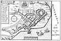 Beaumaris.1610.jpg 1,800 × 1,201; 271 KB
-
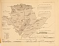 Geological Map Anglesey Callaway1881 Quarterlyjourna371881geol 0263.jpg 2,397 × 1,871; 1.12 MB
-
 Henslow Anglesea (Anglesey) Geological Map 1822.jpg 5,309 × 3,698; 1.12 MB
-
 Holy Head Bay and harbour in Anglesey.gif 1,000 × 758; 180 KB
-
 Kemlyn Bay and harbour in ye north of Anglesey.gif 1,000 × 740; 156 KB
-
 Ordnance Survey One-Inch Sheet 106 Anglesey, Published 1947.jpg 8,254 × 9,572; 8.72 MB
-
 Ordnance Survey One-Inch Sheet 106 Anglesey, Published 1962.jpg 8,259 × 9,918; 9.26 MB
-
 Ordnance Survey One-Inch Sheet 41 Anglesey, Published 1922.jpg 13,542 × 11,131; 45.63 MB
-
 Ordnance Survey Sheet SH 28 (23 28) Holyhead, Published 1950.jpg 7,676 × 8,846; 15.48 MB
-
 Puffin islandmap1947.png 1,041 × 765; 1.18 MB
-
 Speed Beaumaris insert.jpg 752 × 581; 276 KB
.jpg)
.jpg)
.jpg)


.jpg)
.jpg)
.jpg)
.jpg)


.jpg)


_Geological_Map_1822.jpg)


_Holyhead,_Published_1950.jpg)

