Category:Old maps of Bad Homburg vor der Höhe
Use the appropriate category for maps showing all or a large part of Bad Homburg vor der Höhe. See subcategories for smaller areas:
| If the map shows | Category to use |
|---|---|
| Bad Homburg vor der Höhe on a recently created map | Category:Maps of Bad Homburg vor der Höhe or its subcategories |
| Bad Homburg vor der Höhe on a map created more than 70 years ago | Category:Old maps of Bad Homburg vor der Höhe or its subcategories |
| the history of Bad Homburg vor der Höhe on a recently created map | Category:Maps of the history of Bad Homburg vor der Höhe or its subcategories |
| the history of Bad Homburg vor der Höhe on a map created more than 70 years ago | Category:Old maps of the history of Bad Homburg vor der Höhe or its subcategories |
Media in category "Old maps of Bad Homburg vor der Höhe"
The following 5 files are in this category, out of 5 total.
-
 1787 - Homburg-Plan - Friedrich Bruch.jpg 18,413 × 13,851; 54.79 MB
-
 Bad Homburg, Bruchscher Stadtplan von 1787.JPG 2,140 × 1,924; 1.49 MB
-
 Bad Homburg, Coghlans Stadtplan von 1848.JPG 2,076 × 1,620; 1.21 MB
-
 Bad Homburg, Stadtplan von 1857.JPG 2,112 × 1,716; 3.73 MB
-
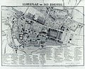
 Meyers5 Frankfurt Homburg.png 723 × 290; 181 KB


