Category:Old maps of Balochistan
Use the appropriate category for maps showing all or a large part of Balochistan. See subcategories for smaller areas:
| If the map shows | Category to use |
|---|---|
| Balochistan on a recently created map | Category:Maps of Balochistan or its subcategories |
| Balochistan on a map created more than 70 years ago | Category:Old maps of Balochistan or its subcategories |
| the history of Balochistan on a recently created map | Category:Maps of the history of Balochistan or its subcategories |
| the history of Balochistan on a map created more than 70 years ago | Category:Old maps of the history of Balochistan or its subcategories |
Subcategories
This category has the following 9 subcategories, out of 9 total.
1
Media in category "Old maps of Balochistan"
The following 31 files are in this category, out of 31 total.
-

-
 1818 Pinkerton Map of Mecran (Balochistan).jpg 2,226 × 1,341; 758 KB
-
 Middle east map (1832).jpg 1,200 × 755; 841 KB
-
 1836 Russian map of Turkey in Asia, Persia, Arabia and a part of Turkestan.jpg 6,712 × 5,912; 7.78 MB
-

-
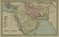
 1850 Mitchell Map of Persia, Arabia and Afghanistan - Geographicus - Arabia-m-50.jpg 4,000 × 3,284; 3.01 MB
-
 1855 Colton Map of Balochistan.jpg 1,068 × 743; 275 KB
-

-

-
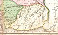
 1862 Johnson Map of Balochistan.jpg 791 × 507; 153 KB
-
-
 Map of Central Asia.jpg 2,938 × 3,480; 2.66 MB
-
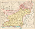
 1946 Map of Baluchistan by National Geographic.jpg 2,041 × 1,889; 820 KB
-
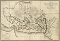 A Map of Beloochistan & Sinde.jpg 11,102 × 7,653; 8.03 MB
-
 A ride to India across Persia and Baluchistan (1891) (14804278413).jpg 2,624 × 3,497; 865 KB
-
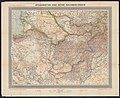 Afghanistan und seine Nachbarländer.jpg 5,302 × 4,316; 11.35 MB
-
 Balochistan region in the year 1789.png 1,510 × 852; 776 KB
-
 Bokhara, Afghanistan, Beloochistan, etc. LOC 2004629039.jpg 4,191 × 5,106; 3.29 MB
-
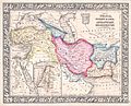
 Iran Turan map 1843.jpg 7,864 × 6,918; 12.74 MB
-
 Kâtip Çelebi's Cihannümâ - map of Persia (Balochistan).tif 3,331 × 2,602; 19.09 MB
-
 Map of Baluchistan from The Imperial Gazetteer of India (1907-1909).jpg 1,000 × 844; 254 KB
-
 Map of Baluchistan States Union and British Baluchistan.png 700 × 600; 20 KB
-
 Map of the Persian-Afghan border campaign of Reginald Dyer.jpg 748 × 467; 46 KB
-

-
 Map of Turkey, Persia, Mecran (Balochistan).jpg 1,756 × 1,480; 899 KB
-
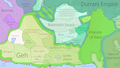
 Marri and bugti countries.jpg 278 × 263; 31 KB
-
 Mitchell Map 1850 country of Balochistan.jpg 1,235 × 737; 442 KB
-
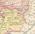
 Overview of Afghanistan and the Countries on the Northwest Border of India WDL217.png 1,118 × 1,024; 2.39 MB
-
 Persia, Arabia, Tartary, Afghanistan by Thomas Gamaliel Bradford - WDL.png 1,024 × 1,308; 2.23 MB
-
 The gates of India, being an historical narrative (1910) (14764341255).jpg 3,094 × 3,554; 1.92 MB
-
 The Helmund River. LOC 2006627703.tif 4,420 × 5,320; 67.28 MB
_-_Geographicus_-_RegnumPersicum-ottens-1730_(Mecran).jpg)
.jpg)
.jpg)


_-_Geographicus_-_Persia-mitchell-1864.jpg)


_(14804278413).jpg)


.jpg)


.jpg)


_(14764341255).jpg)
.jpg)