Category:Old maps of Benin
Countries of Africa: Algeria · Angola · Benin · Botswana · Burkina Faso · Burundi · Cameroon · Cape Verde · Central African Republic · Chad · Comoros · Democratic Republic of the Congo · Republic of the Congo · Djibouti · Egypt‡ · Equatorial Guinea · Eritrea · Eswatini · Ethiopia · Gabon · The Gambia · Ghana · Guinea · Guinea-Bissau · Ivory Coast · Kenya · Lesotho · Liberia · Libya · Madagascar · Malawi · Mali · Mauritania · Mauritius · Morocco · Mozambique · Namibia · Niger · Nigeria · Rwanda · São Tomé and Príncipe · Senegal · Seychelles · Sierra Leone · Somalia · South Africa · South Sudan · Sudan · Tanzania · Togo · Tunisia · Uganda · Zambia · Zimbabwe
Limited recognition: Puntland · Somaliland – Other areas: Canary Islands · Ceuta · Madeira · Mayotte · Melilla · Réunion · Western Sahara
‡: partly located in Africa
Limited recognition: Puntland · Somaliland – Other areas: Canary Islands · Ceuta · Madeira · Mayotte · Melilla · Réunion · Western Sahara
‡: partly located in Africa
Use the appropriate category for maps showing all or a large part of Benin. See subcategories for smaller areas:
| If the map shows | Category to use |
|---|---|
| Benin on a recently created map | Category:Maps of Benin or its subcategories |
| Benin on a map created more than 70 years ago | Category:Old maps of Benin or its subcategories |
| the history of Benin on a recently created map | Category:Maps of the history of Benin or its subcategories |
| the history of Benin on a map created more than 70 years ago | Category:Old maps of the history of Benin or its subcategories |
Subcategories
This category has the following 5 subcategories, out of 5 total.
- 17th-century maps of Benin (6 F)
- 18th-century maps of Benin (4 F)
- 19th-century maps of Benin (20 F)
O
Media in category "Old maps of Benin"
The following 6 files are in this category, out of 6 total.
-

-
 Image taken from page 281 of 'Du Dahomé au Sahara. La nature et l'homme' (11253464174).jpg 2,542 × 3,493; 1.43 MB
-
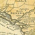
 Large areas of Warri map.jpg 750 × 852; 110 KB
-
 Map WestAfrica 16cent Blake.png 4,575 × 3,313; 1.13 MB
-
 Old map of Warri.jpg 512 × 512; 73 KB
-

.jpg)
.jpg)


