Category:Old maps of Bratislava
Subcategories
This category has only the following subcategory.
Media in category "Old maps of Bratislava"
The following 22 files are in this category, out of 22 total.
-
 509 of 'Pozsony város története' (11301179623).jpg 1,613 × 983; 329 KB
-
 1683-Türkenkrieg um Wien.JPG 1,761 × 1,729; 3 MB
-

-
 BERMANN(1880) p0547 Plan von Wien um 1440.jpg 900 × 622; 281 KB
-
 Aufnahmeblatt 4758-1 UNG Theben, Marchmündung.jpg 9,310 × 7,134; 50.47 MB
-

-

-
 156 of 'Pozsony város története' (11124854884).jpg 1,088 × 715; 168 KB
-

-
 Bratislava BV035895037.jpg 9,378 × 7,169; 9.08 MB
-
 Aufnahmeblatt 4758-2 Pressburg.jpg 9,306 × 7,139; 37.44 MB
-
 Aufnahmeblatt 4758-4 Kroatisch Jahrndorf, Karlburg, Engerau.jpg 9,454 × 7,398; 34.28 MB
-
 Bratislava map ca. 1940.jpg 4,032 × 3,024; 4.66 MB
-
 Gemaniae-Tabula-(Sebastian-Muenster).jpg 1,200 × 923; 599 KB
-
 HISTORIA.jpg 2,388 × 1,054; 428 KB
-
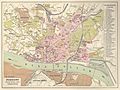
 Map-Pozsony1895.jpg 1,837 × 1,403; 742 KB
-
 Map-Pressburg1905.jpg 2,631 × 1,555; 3.71 MB
-
 Pozsony-1910.jpg 2,632 × 1,975; 1.04 MB
-
 Pressburg - 35-48.jpg 3,387 × 4,972; 3.61 MB
-
 Pressburg city plan 1438-55.jpg 1,104 × 814; 783 KB
-
 Stara-Gorkeho.jpg 755 × 500; 90 KB
-
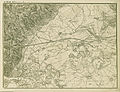
 Umgebung der K. Freistadt Pressburg - gezeichnet von Hauptmann A. Stephanie - btv1b53027750z.jpg 8,256 × 11,033; 20.79 MB
.jpg)


_p0547_Plan_von_Wien_um_1440.jpg)

.jpg)
.jpg)
.jpg)
%27_(11303556865).jpg)


.jpg)


