Category:Old maps of Brazil from the Norman B. Leventhal Map Center
Media in category "Old maps of Brazil from the Norman B. Leventhal Map Center"
The following 8 files are in this category, out of 8 total.
-
 Brazil - from official and other sources (14773171969).jpg 1,929 × 2,000; 4.11 MB
-
 Brésil - carte politique et économique (14959850335).jpg 2,000 × 1,974; 4.72 MB
-
 Carta geral do estado de S. Paulo (14961561852).jpg 2,000 × 1,341; 2.64 MB
-
-
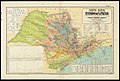
 Carte de voies de communication du Brésil (14775299148).jpg 2,000 × 1,738; 3.92 MB
-
 Carte economique du Brésil (14959851175).jpg 1,907 × 2,000; 3.99 MB
-
 Mapa do Brazil - (esboço) (outline) (14773238608).jpg 1,990 × 2,000; 4.18 MB
-
 Mappa geral do Brasil (14773171129).jpg 1,849 × 2,000; 4.04 MB
.jpg)
.jpg)
.jpg)
.jpg)
.jpg)
.jpg)
_(outline)_(14773238608).jpg)
.jpg)