Category:Old maps of Cairo
Subcategories
This category has the following 4 subcategories, out of 4 total.
Media in category "Old maps of Cairo"
The following 21 files are in this category, out of 21 total.
-
 Cairo map pre1200 byLanePoole.png 555 × 727; 651 KB
-
 Plan of Cairo before 1200. (c.1894) - TIMEA.jpg 747 × 1,024; 135 KB
-
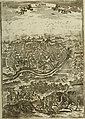
 The story of Cairo (1906) (14782234955).jpg 1,676 × 2,200; 453 KB
-
 Cairo map1492 schedel.jpg 821 × 1,167; 251 KB
-
 Nile-Cairo-Giza.jpg 584 × 846; 314 KB
-
 Piri Ries Cairo Map.png 1,765 × 2,238; 8.7 MB
-
 Cairo map1620 Dapper.jpg 850 × 585; 159 KB
-
 Description de l'univers (1683) (14761212046).jpg 2,152 × 3,016; 1.58 MB
-
 Cairo map1736 Pocoke.jpg 850 × 716; 159 KB
-

-
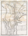 MemphisJamesRennell01.jpg 1,442 × 1,849; 231 KB
-
 111 of 'The Rob Roy on the Jordan, Nile, Red Sea, & Gennesareth, etc' (11088188094).jpg 2,096 × 1,283; 834 KB
-
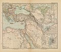 Afrika in 6 Blättern, Sheet 2. - DPLA - 39177aedfe3e739eea71ac7e1c8552db.jpg 1,000 × 846; 263 KB
-
 98 of '(Wintering in Egypt.)' (11233870195).jpg 1,296 × 2,030; 511 KB
-
 99 of '(Wintering in Egypt.)' (11231368116).jpg 1,269 × 2,054; 383 KB
-
 D185-De Memphis à Heliopolis.-L2-Ch6.png 1,524 × 2,124; 275 KB
-
 Niebuhr1774abd1 Cairo.jpg 4,247 × 2,636; 3.92 MB
-

-
 Piri Reis - The City of Cairo - Walters W658305A - Full Page.jpg 1,227 × 1,800; 899 KB
-
 Saladin and the fall of the Kingdom of Jerusalem (1898) (14781391641).jpg 2,000 × 2,356; 421 KB
-
 القاهرة في عهد الفاطميين.jpg 416 × 695; 120 KB

_-_TIMEA.jpg)
_(14782234955).jpg)


_(14761212046).jpg)


.jpg)

%27_(11233870195).jpg)
%27_(11231368116).jpg)


_and_Old_Cairo_(Vieux_Kaire,_right)_Environs_du_Kaire_(Cairo)._Plan_g%C3%A9n%C3%A9ral_de_Boul%C3%A2q,_du_Kaire,_de_l%27%C3%AEle_de_Roudah_(el-R%C3%B4da),_du_Vieux_Kaire_et_de_Gyzeh_(J%C3%AEzah)_(NYPL_b14212718-1268726)_(cropped).jpg)

_(14781391641).jpg)
