Category:Old maps of Colchester
Subcategories
This category has the following 2 subcategories, out of 2 total.
Media in category "Old maps of Colchester"
The following 17 files are in this category, out of 17 total.
-

-

-
 128 of '(Our own country. Descriptive, historical, pictorial.)' (11175034704).jpg 1,928 × 1,601; 930 KB
-
 474 of '(Our own country. Descriptive, historical, pictorial.)' (11212610086).jpg 1,889 × 1,585; 888 KB
-
 126 of '(Our own country. Descriptive, historical, pictorial.)' (11245973823).jpg 1,935 × 1,576; 938 KB
-
 Colchester Map 1500AD.png 2,148 × 1,576; 387 KB
-
 Colchester, May the- 6-th- Day- A.D.- 1765. LOC gm71000952.jpg 4,848 × 4,243; 2.04 MB
-
 Colchester, May the- 6-th- Day- A.D.- 1765. LOC gm71000952.tif 4,848 × 4,243; 58.85 MB
-
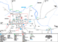
 Colchestermap.jpg 556 × 378; 46 KB
-
 Colchestermap1940.jpg 3,504 × 2,544; 1.68 MB
-
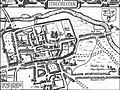
 Ichnography of Colchester 1768.png 1,523 × 884; 2.38 MB
-
 John Speed Colchester 1610.jpg 463 × 348; 54 KB
-
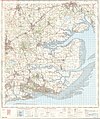
 Ordnance Survey One-Inch Sheet 149 Colchester, Published 1946.jpg 10,992 × 12,810; 16.25 MB
-
 Ordnance Survey One-Inch Sheet 162 Southend-on-Sea, Published 1957.jpg 8,323 × 9,954; 10.3 MB
-
 Ordnance Survey One-Inch Sheet 162 Southend-on-Sea, Published 1969.jpg 8,285 × 9,899; 34.34 MB
-
 Siege of Colchester map 1648 detail.png 698 × 631; 487 KB
-
 Siege of Colchester map 1648.png 1,290 × 975; 2.35 MB
_With_maps_and_plans.)%27_(11108845223).jpg)
.jpg)
%27_(11175034704).jpg)
%27_(11212610086).jpg)
%27_(11245973823).jpg)


