Category:Old maps of Concarneau
Media in category "Old maps of Concarneau"
The following 19 files are in this category, out of 19 total.
-

-
 Carte de Cassini Concarneau et ses environs.jpg 1,600 × 900; 1.24 MB
-
 Concarneau 025 Plan cadastral de la commune 1808.JPG 2,706 × 1,726; 2.48 MB
-
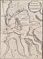
 Conquereau Tassin 16007.jpg 3,339 × 2,332; 4.52 MB
-
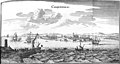 Conquerneau 1657 Zeiller 45090.jpg 3,179 × 1,688; 3.25 MB
-
 Conquerneau Tassin 16008.jpg 3,267 × 2,293; 5.02 MB
-
 Plan de Concarneau - Bellin - btv1b8591938n.jpg 3,587 × 4,591; 2.66 MB
-
 Plan de Concarneau - btv1b531532895.jpg 4,072 × 6,274; 2.61 MB
-
 Plan de Concarneau au XVIIIème siècle.jpg 1,252 × 960; 501 KB
-
 Plan de Concarneau en 1764.jpg 754 × 1,024; 632 KB
-
 Plan de Concarneau.jpg 454 × 490; 58 KB
-
 Plan de la Ville close en 1758.jpg 1,501 × 883; 609 KB
-
 Plan Passage Concarneau.png 1,142 × 734; 668 KB
-
 Plan porte du Passage Concarneau.png 1,236 × 827; 754 KB
-
 Ville de Concarneau - Robelin - btv1b53153293w.jpg 6,062 × 4,612; 2.96 MB
-
 Ville de Concarneau - Robelin - btv1b53153294b.jpg 6,380 × 4,230; 3.42 MB
-
 Ville et environs de Concarneau - de la Voye - btv1b53153286t.jpg 8,342 × 5,364; 6.59 MB
-
 Ville et environs de Concarneau - de la Voye - btv1b531532878.jpg 8,224 × 6,448; 7.58 MB
-
 Vue de Concarneau et des passes - D. Laisné - btv1b53153292f.jpg 4,166 × 3,058; 1.66 MB


