Category:Old maps of Cumberland
Ceremonial counties of England: Bedfordshire · Berkshire · Buckinghamshire · Cambridgeshire · Cheshire · Cornwall · Cumbria · Derbyshire · Devon · Dorset · Durham · East Riding of Yorkshire · East Sussex · Essex · Gloucestershire · Greater London · Greater Manchester · Hampshire · Herefordshire · Hertfordshire · Isle of Wight · Kent · Lancashire · Leicestershire · Lincolnshire · Norfolk · North Yorkshire · Northamptonshire · Northumberland · Nottinghamshire · Oxfordshire · Rutland · Shropshire · Somerset · South Yorkshire · Staffordshire · Suffolk · Surrey · Warwickshire · West Midlands · West Sussex · West Yorkshire · Wiltshire · Worcestershire
City-counties: Bristol · City of London
Former historic counties: Cumberland · Huntingdonshire · Middlesex · Sussex · Westmorland · Yorkshire
Other former counties:
City-counties: Bristol · City of London
Former historic counties: Cumberland · Huntingdonshire · Middlesex · Sussex · Westmorland · Yorkshire
Other former counties:
Subcategories
This category has the following 4 subcategories, out of 4 total.
- Old county maps of Cumberland (13 F)
- Ordnance Survey 1st series 1:10560, Map of Cumberland (1 P, 184 F)
C
- Old maps of Carlisle (10 F)
Media in category "Old maps of Cumberland"
The following 19 files are in this category, out of 19 total.
-

-

-

-
 Print, map (BM 1881,1008.143).jpg 2,500 × 1,285; 439 KB
-
 Print, book-illustration, map (BM 1871,0812.3259).jpg 2,500 × 1,456; 237 KB
-

-
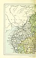
 1836 Cumberland County Map Print A. Fullarton Carlisle.jpg 5,008 × 6,176; 11.25 MB
-

-
 228 of 'Home Geography of England and Wales ... With ... maps, etc' (11222298103).jpg 1,284 × 2,087; 714 KB
-
 29 of 'The “Beaumont” Geography and Map Tracing Book' (11248025025).jpg 1,970 × 2,003; 683 KB
-
 A1528793h.jpg 748 × 1,050; 645 KB
-
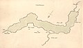
 20 of 'Annals of the Solway until A.D. 1307. (With maps.)' (11251543894).jpg 2,496 × 1,848; 872 KB
-

-

-
 28 of 'An Essay on the Geology of Cumberland and Westmorland' (11243747454).jpg 1,335 × 1,327; 272 KB
-

-
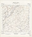
 Ordnance Survey Sheet NY 36 (35 36) Longtown, Published 1948.jpg 7,700 × 9,830; 12.61 MB
-
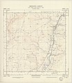
 Ordnance Survey Sheet NY 47 (35 47) Rowanburn, Published 1950.jpg 7,668 × 8,869; 12.15 MB
-
 Ordnance Survey Sheet NY 48 (35 48) Newcastleton, Published 1950.jpg 7,680 × 8,876; 12.49 MB
.jpg)
.jpg)
.jpg)
.jpg)
.jpg)
.jpg)

%27_(11055931176).jpg)
.jpg)
.jpg)

%27_(11251543894).jpg)
.jpg)
%27_(11108819453).jpg)
.jpg)

_Longtown,_Published_1948.jpg)
_Rowanburn,_Published_1950.jpg)
_Newcastleton,_Published_1950.jpg)