Category:Old maps of Daugavpils
Media in category "Old maps of Daugavpils"
The following 8 files are in this category, out of 8 total.
-
 BM01246abm.jpg 640 × 590; 130 KB
-
 R1882.jpg 867 × 474; 204 KB
-
 R1913.jpg 1,283 × 701; 338 KB
-
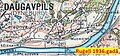 R1936b.jpg 743 × 347; 139 KB
-
 USSR map NN 35-2 -verso- Daugavpils and Vicinity.jpg 2,455 × 2,431; 1.33 MB
-
 USSR map NN 35-2 Daugavpils.jpg 5,724 × 4,385; 8.52 MB
-
 WIG Mapa Operacyjna Polski - 28 Głębokie-Dyneburg 1933.jpg 8,656 × 7,841; 14.82 MB
-
 Планы городов из Полного собрания законов Российской империи 264.jpg 2,987 × 2,408; 1.42 MB


