Category:Old maps of Dortmund
Use the appropriate category for maps showing all or a large part of Dortmund. See subcategories for smaller areas:
| If the map shows | Category to use |
|---|---|
| Dortmund on a recently created map | Category:Maps of Dortmund or its subcategories |
| Dortmund on a map created more than 70 years ago | Category:Old maps of Dortmund or its subcategories |
| the history of Dortmund on a recently created map | Category:Maps of the history of Dortmund or its subcategories |
| the history of Dortmund on a map created more than 70 years ago | Category:Old maps of the history of Dortmund or its subcategories |
Subcategories
This category has the following 3 subcategories, out of 3 total.
M
- Messtischblatt Dortmund (4 F)
~
Media in category "Old maps of Dortmund"
The following 8 files are in this category, out of 8 total.
-

-
 Dortmund Territorium 1681.jpg 1,226 × 888; 774 KB
-
 HellwegDortmund1610Muhler.jpg 1,298 × 714; 699 KB
-
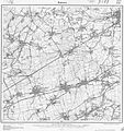 Messtischblatt 4411 Kamen 1907.jpg 1,654 × 1,763; 933 KB
-
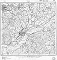 Messtischblatt 4511 Hoerde 1907.jpg 1,654 × 1,763; 1,008 KB
-
 Reichsstadt Dortmund Territorium - 1760 Rizzi Zannoni.png 1,920 × 1,080; 4.37 MB
-
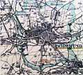 Stadtplan-Ludorff-Dortmund-1894-IMG 2381.jpg 1,926 × 1,734; 3.63 MB
-


