Category:Old maps of Elmina
Subcategories
This category has only the following subcategory.
M
Media in category "Old maps of Elmina"
The following 13 files are in this category, out of 13 total.
-

-
 Bergeman - Elmina (1799).png 2,978 × 2,081; 7.41 MB
-
 AMH-6780-NA Map of El Mina Fort.jpg 2,400 × 1,730; 663 KB
-
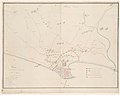
 AMH-7717-NA Floor plan of the Coenraadsburg and St. George forts at Elmina.jpg 2,400 × 865; 317 KB
-
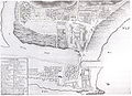
 AMH-7724-NA Map of Elmina showing the forts of St. George and Coenraadsburg.jpg 2,400 × 1,674; 594 KB
-
 Eene opname der Nederlandsche bezittingen te St. George d'Elmina (1829).jpg 4,845 × 3,615; 1.12 MB
-
 Elmina 1647.jpg 4,004 × 3,235; 1.62 MB
-
 Elmina1799.jpg 842 × 608; 415 KB
-
 Elmina1898.jpg 526 × 942; 321 KB
-
-
 Kaart van de afdeeling Elmina (1859).jpg 5,000 × 4,026; 1.41 MB
-

-
 Plattegrond van de forten St. George del Mina en Koenraadsburg en hun omgeving.jpg 4,898 × 3,923; 1.21 MB

.png)


.jpg)


,_NG-1998-9.jpg)
.jpg)
.jpg)
