Category:Old maps of Ezo
Subcategories
This category has the following 6 subcategories, out of 6 total.
E
- Ezo Kairiku Rotei Zenzu (2 F)
- Ezo Kōkyō Yochi Zenzu (4 F)
- Ezo no Kuni Zenzu (5 F)
K
P
- Plan et Vues de la Terre d'Yeco (12 F)
T
Media in category "Old maps of Ezo"
The following 11 files are in this category, out of 11 total.
-
 Illustrated general route map of three countries (14590511136).jpg 2,500 × 1,764; 1.2 MB
-
 Ezo&karafuto.jpg 800 × 1,090; 92 KB
-
 Hokkai e-zu mirror dedicated by Takeshiro Matsuura at Kitano Tenmangu (rubbing).jpg 1,543 × 2,317; 1.71 MB
-
 Mallet-TerredeGesso.png 555 × 749; 731 KB
-
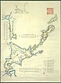
 Map of Ezo (14764785933).jpg 2,500 × 1,643; 1.4 MB
-
 Map of Jesso, 1719.jpg 851 × 1,021; 170 KB
-
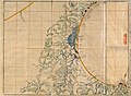
 Revised map of Ezo (14942875519).jpg 1,557 × 2,000; 1.24 MB
-
 Shōhō Nihon zu - N.Honshū & Ezo-chi (National Museum of Japanese History) (detail).jpg 2,200 × 2,631; 265 KB
-
 Tenpō Kuniezu - Matsumae-no-Kuni (National Archives of Japan).jpg 4,917 × 6,517; 3.48 MB
-
 実験北蝦夷山川地理取調図 松浦武四郎.jpg 3,420 × 2,507; 5.99 MB
-
 蝦夷闔境山川地理取調大概図 松浦武四郎.jpg 2,932 × 2,224; 998 KB
.jpg)

.jpg)

.jpg)

.jpg)
_(detail).jpg)
.jpg)

