Category:Old maps of Hasselt
Hasselt in Belgium, not in Overijssel, the Netherlands.
Media in category "Old maps of Hasselt"
The following 14 files are in this category, out of 14 total.
-
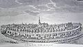 Hasselt in 1740.jpg 800 × 459; 70 KB
-
 Hasselt in 1759.jpg 800 × 698; 173 KB
-
 Hasselt, Belgium ; Ferraris Map.jpg 652 × 564; 53 KB
-
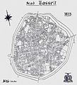 Hasselt 1813.jpg 729 × 800; 169 KB
-
 Atlante Neroni - Hasselt.jpg 2,325 × 1,498; 698 KB
-
 Atlas buurtwegen, Hasselt.jpg 700 × 504; 116 KB
-
 Hasselt - 222452 - onroerenderfgoed.jpg 640 × 399; 257 KB
-
 Hasselt Ferraris.png 719 × 423; 896 KB
-
 Map of Hasselt, 19th century.jpg 2,255 × 1,926; 3.93 MB
-
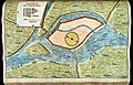
 Map of the landscape between Hasselt and Zonhoven.jpg 2,358 × 1,913; 444 KB
-
 Plan of fortification of Hasselt, 1831.jpg 2,797 × 2,077; 6.87 MB
-
 Plan voor het Leopoldplein, Hasselt.jpg 2,495 × 1,823; 5.1 MB
-
 Primitief kadasterplan Abdij Herkenrode 1840-1843.png 1,753 × 691; 1.36 MB
-
 Rioleringsplan voor de stad Hasselt, ca 1860.jpg 2,791 × 2,215; 8.84 MB


