Category:Old maps of Kalmar
Media in category "Old maps of Kalmar"
The following 9 files are in this category, out of 9 total.
-

-

-
 Admiralty Chart No 2360 Sweden Sheet 1 Falsterbo Point to Kalmar Sound, Published 1855.jpg 12,011 × 9,050; 11.46 MB
-
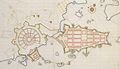 Kalmar 1650.jpg 1,669 × 960; 319 KB
-
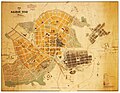
 Kalmar 1877.jpg 1,317 × 1,518; 793 KB
-
 Kalmar 1906.jpg 1,984 × 1,536; 1.02 MB
-
 Kalmar karta ugglan.jpg 1,532 × 1,226; 388 KB
-
 Ljunggren Kalmar detaljkarta (cropped).png 2,395 × 1,777; 5.03 MB
-
 Ljunggren Kalmar.png 4,110 × 4,910; 21.15 MB
.jpg)
.jpg)


.png)
