Category:Old maps of Kalvola
Media in category "Old maps of Kalvola"
The following 11 files are in this category, out of 11 total.
-
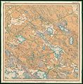
 Parish map of Kalvola in Finland, square 2113 11.jpg 6,858 × 6,341; 3.36 MB
-
 Parish map of Kalvola in Finland, square 2113 12.jpg 6,270 × 6,113; 3.38 MB
-
 Parish map of Kalvola in Finland, square 2114 07.jpg 6,200 × 6,617; 3.29 MB
-
 Parish map of Kalvola in Finland, square 2114 10.jpg 6,323 × 6,367; 3.64 MB
-
 Parish map of Kalvola in Finland, square 2131 02.jpg 4,738 × 5,574; 1.98 MB
-
 Parish map of Kalvola in Finland, square 2131 03, 2131 06.jpg 7,653 × 7,688; 3.9 MB
-
 Parish map of Kalvola in Finland, square 2132 01.jpg 3,072 × 3,323; 1.03 MB
-
 Parish map of Kalvola in Finland, square 2132 04, 2132 05.jpg 3,072 × 3,505; 713 KB
-
 Senate Atlas, 1870–1907. Sheet XIII 25 Tammela.jpg 7,043 × 7,127; 8.42 MB
-
 Senate Atlas, 1870–1907. Sheet XIV 24 Urjala.jpg 6,996 × 7,053; 8.07 MB
-
 Senate Atlas, 1870–1907. Sheet XV 24 Kalvola.jpg 6,947 × 7,077; 8.45 MB


