Category:Old maps of Kashmir
Subcategories
This category has the following 4 subcategories, out of 4 total.
O
- Old maps of Gilgit-Baltistan (3 F)
Media in category "Old maps of Kashmir"
The following 53 files are in this category, out of 53 total.
-

-

-

-

-
 1821 Carey Map of India - Geographicus - India-carey-1821 (cropped).jpg 3,136 × 3,333; 2.57 MB
-
 1821 Carey Map of India - Geographicus - India-carey-1821.jpg 5,000 × 4,130; 6.29 MB
-

-
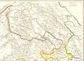 Ladakh-Garhwal-1863.jpg 2,340 × 1,700; 1.38 MB
-
 The Quarterly journal of the Geological Society of London (14154902110).jpg 2,000 × 1,247; 603 KB
-
 The Quarterly journal of the Geological Society of London, Volume XXXIV, Plate XIV.jpg 1,728 × 1,080; 540 KB
-
 Pope1880Beluch2.jpg 930 × 1,200; 610 KB
-
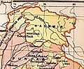
 Area of Kashmir.png 1,366 × 667; 2.07 MB
-
 1894 Bagrot Hunza Nagyr and Hispar Glacier by Conway.jpg 11,016 × 7,128; 8.45 MB
-
 Map of Tibet in 1905, from- 079 ostindien (1905) (cropped).png 1,166 × 702; 541 KB
-
 Caboul Peshawer from Asie 1 to 1,000,000. flle 36N-72E.jpg 8,936 × 7,064; 10.37 MB
-
 1912 China map from National Geographic.jpg 6,980 × 5,326; 10.65 MB
-
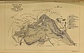
 1923 SoI map of Dras Marpola Shingo.jpg 1,513 × 1,197; 835 KB
-
 1940 Kashmir Jammu and Gilgit Agency by Survey of India.jpg 9,944 × 8,866; 5.45 MB
-

-
 Chah-i-Doulla (Shahidulla) and environs 1 - French Army map.jpg 3,101 × 1,509; 2.42 MB
-
 Darel-Tangir-Chilas.png 1,581 × 1,403; 4.76 MB
-
 Djammou-Kachmir from Asie 1 to 1,000,000. flle 36N-78E.jpg 9,000 × 7,128; 10.52 MB
-
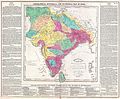
 Map of India showing the distribution of langages - Beames 1868.jpg 1,400 × 1,383; 266 KB
-
 Jammu and Kashmir in 1888 Survey of India map.jpg 5,113 × 3,513; 5.64 MB
-
 Jammu and Kashmir in 1909 map from the Imperial Gazetteer.jpg 350 × 290; 110 KB
-
 Jammu and Kashmir in 1954 Political Map of India.jpg 1,014 × 700; 176 KB
-
 Joppen1907India1805a-21.jpg 843 × 1,200; 289 KB
-
 Kashmir Map.jpg 7,723 × 11,478; 30.89 MB
-
 Ladakh 1733.jpg 3,552 × 2,308; 3.12 MB
-
 Ladakh 1792.jpg 1,899 × 1,440; 1.43 MB
-
 Map India and Pakistan 1-250,000 Tile NI 43-6 Srinagar and Vicinity (verso).jpg 5,000 × 3,813; 1.04 MB
-

-
 Map of Central Asia to Accompany the Paper by Captn H Trotter RE.png 6,000 × 5,440; 62.56 MB
-
 Map of Kashmir, drawn by J. O. N. James, 1861 (F08-25).jpg 24,938 × 16,736; 27.09 MB
-
 Map of Kashmir, drawn by J. O. N. James, 1861 (F08-25-1).jpg 10,103 × 17,664; 12.22 MB
-
 Map of Kashmir, drawn by J. O. N. James, 1861 (F08-25-2).jpg 10,103 × 17,664; 11.74 MB
-
 Map of Kashmir, drawn by J. O. N. James, 1861 (F08-25-3).jpg 6,283 × 17,037; 6.23 MB
-

-

-

-
 Map of Tibet in 1821 Carey Map of India - Geographicus - India-carey-1821 (cropped).jpg 1,942 × 1,062; 541 KB
-

-

-
 North-Western India in 1946 map of India by National Geographic.jpg 2,185 × 1,813; 927 KB
-
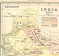 NWIndia 1837 imperial gazeteer.jpg 1,537 × 1,450; 313 KB
-
 Provincial Geographies of India Volume 1 0129.jpg 1,451 × 1,345; 442 KB
-
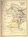
 Punjab-NWFP-Kashmir-1863.jpg 2,340 × 1,700; 1.22 MB
-

-
 Txu-pclmaps-oclc-181831961-dras-42-n-1923.jpg 3,375 × 4,780; 1.9 MB
-
 Txu-pclmaps-oclc-181831961-dras-43-n-1958.jpg 3,849 × 5,309; 2.96 MB
-
 Txu-pclmaps-oclc-181831961-kargil-52-b-1928.jpg 3,327 × 4,963; 2.23 MB
-
 Txu-pclmaps-oclc-181831961-kargil-52-b-1946.jpg 3,806 × 5,464; 3.01 MB
-
 Txu-pclmaps-oclc-181831961-ladakh-52-b-1916.jpg 3,509 × 4,533; 3.56 MB
_%22KASHMIR%22_%22PENGAB%22_(Punjab)_map_detail_from-_1770_Bonne_Map_of_Northern_India,_Burma_and_Pakistan_-_Geographicus_-_IndiaNorth-bonne-1770_(cropped).jpg)
.jpg)
.jpg)
.jpg)
.jpg)

.jpg)

.jpg)


_(cropped).png)


_and_environs_1_-_French_Army_map.jpg)


.jpg)


.jpg)
.jpg)
.jpg)
.jpg)
.jpg)
.jpg)
.jpg)
.jpg)
.jpg)


.jpg)


.jpg)