Category:Old maps of Kinmen
中文(臺灣):金門縣的歷史地圖
Media in category "Old maps of Kinmen"
The following 15 files are in this category, out of 15 total.
-
 Admiralty Chart No 1029 Aimoey Harbour Entrance of Chinchew River, Published 1792.jpg 3,236 × 4,152; 2.68 MB
-

-
 Album of Hongkong Canton Macao Amoy Foochow 050.jpg 1,287 × 1,219; 655 KB
-
 AMH-5171-NA Map of Macao, Amy and Quemoy.jpg 2,400 × 1,694; 490 KB
-
 Amoy (Xiamen) and Kinmen 1936 亞新地學社1936年《袖珍中華全圖》--14福建省厦門市.jpg 521 × 393; 105 KB
-
 Bodleian Libraries, East China Sea and Formosa Strait by John Thornton, 1701.jpg 672 × 1,000; 115 KB
-
 Fokyen.jpg 1,127 × 1,032; 205 KB
-
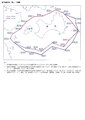 Kinmen area restricted (prohibited) waters map.pdf 1,239 × 1,754; 104 KB
-

-
 Shinkoku higashi kaigan Amoi-kō no zu = China east coast, Amoy Harbour LOC 2002626755.jpg 5,344 × 4,233; 2.38 MB
-
 Shinkoku higashi kaigan Amoi-kō no zu = China east coast, Amoy Harbour LOC 2002626755.tif 5,344 × 4,233; 64.72 MB
-
 Txu-oclc-10552568-ng50-15.jpg 5,000 × 3,808; 5.91 MB
-
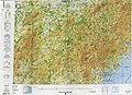 Txu-pclmaps-oclc-22834566 h-12d.jpg 9,246 × 6,704; 21.31 MB
-
 Zheng Zhilong and Koxing Map.jpg 640 × 530; 97 KB
-
 亚新地学社1936年《袖珍中华全图》--14福建省.jpg 1,544 × 2,146; 789 KB


_and_Kinmen_1936_%E4%BA%9E%E6%96%B0%E5%9C%B0%E5%AD%B8%E7%A4%BE1936%E5%B9%B4%E3%80%8A%E8%A2%96%E7%8F%8D%E4%B8%AD%E8%8F%AF%E5%85%A8%E5%9C%96%E3%80%8B--14%E7%A6%8F%E5%BB%BA%E7%9C%81%E5%8E%A6%E9%96%80%E5%B8%82.jpg)


.jpg)


