Category:Old maps of La Rioja (Spain)
Provinces of Spain: Asturias‡ · Balearic Islands‡ · Biscay · Cantabria‡ · Castellón · A Coruña · Gipuzkoa · Guadalajara · Lugo · Madrid‡ · Murcia‡ · Navarre‡ · Ourense · Pontevedra · La Rioja‡ · Salamanca · Soria · Toledo · Autonomous cities: Ceuta · Melilla
‡: uniprovincial autonomous communities.
‡: uniprovincial autonomous communities.
Autonomous communities of Spain: Andalusia · Aragon · Asturias · Balearic Islands · Basque Autonomous Community · Canary Islands · Cantabria · Castile and León · Castile-La Mancha · Catalonia · Extremadura · Galicia · Community of Madrid · Region of Murcia · Navarre · La Rioja · Valencian Community · Autonomous cities: Ceuta · Melilla
Use the appropriate category for maps showing all or a large part of La Rioja. See subcategories for smaller areas:
| If the map shows | Category to use |
|---|---|
| La Rioja on a recently created map | Category:Maps of La Rioja (Spain) or its subcategories |
| La Rioja on a map created more than 70 years ago | Category:Old maps of La Rioja (Spain) or its subcategories |
| the history of La Rioja on a recently created map | Category:Maps of the history of La Rioja (Spain) or its subcategories |
| the history of La Rioja on a map created more than 70 years ago | Category:Old maps of the history of La Rioja (Spain) or its subcategories |
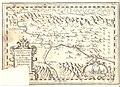
Media in category "Old maps of La Rioja (Spain)"
The following 5 files are in this category, out of 5 total.
-
 Mapa de los partidos de Santo Domingo de la Calzada y Logroño (1787, Tomás López).jpg 3,378 × 3,156; 1.66 MB
-
-
 Mapa de La Rioja de Tomás López 1769.jpg 1,500 × 1,352; 437 KB
-
 Mapa de La Rioja de Tomás López, año 1769.jpg 3,440 × 3,376; 3.24 MB
-

.jpg)
_parte_de_Navarra,_parte_de_%C3%81lava_y_parte_de_La_Rioja.jpg)


.jpg)