Category:Old maps of Le Havre
Subcategories
This category has the following 5 subcategories, out of 5 total.
- 17th-century maps of Le Havre (16 F)
- 18th-century maps of Le Havre (20 F)
- 20th-century maps of Le Havre (18 F)
Media in category "Old maps of Le Havre"
The following 9 files are in this category, out of 9 total.
-
 Carte des rades et baie du Havre de Grâce - btv1b8440150d.jpg 4,330 × 5,902; 3.25 MB
-
 Le Havre - btv1b8442710k.jpg 6,585 × 4,694; 4.54 MB
-
 Plan du Havre de grâce - btv1b8441076m.jpg 8,338 × 6,301; 7.37 MB
-
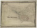
 34 of 'Le Havre, son passé, son présent, son avenir. (With plates.)' (11244102164).jpg 1,336 × 1,473; 285 KB
-

-

-

-
 Plan général de la ville et du port du Havre - btv1b53250938j.jpg 12,678 × 8,412; 17.09 MB
-
 Ville, citadelle et Port du Havre avec ses accroissements - btv1b8494519m.jpg 7,674 × 5,424; 4.74 MB


%27_(11244102164).jpg)
.jpg)
.jpg)
.jpg)

