Category:Old maps of Leningrad
Media in category "Old maps of Leningrad"
The following 23 files are in this category, out of 23 total.
-
 Len1935city.jpg 1,969 × 2,742; 1.54 MB
-
 1941 German military map - Mil.-Geo.-Plan von Leningrad.jpg 19,769 × 24,398; 68.1 MB
-
 Krasnoe Selo-Ropsha.JPG 1,000 × 1,251; 326 KB
-
 Novgorodsko-Luzhskaya operatsiya 1944.jpg 981 × 1,494; 586 KB
-
 Central Leningrad. 6-71. LOC 76693339.jpg 13,185 × 11,618; 20.34 MB
-
 Central Leningrad. 6-71. LOC 76693339.tif 13,185 × 11,618; 438.26 MB
-
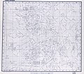
 Len1933 tr.jpg 3,054 × 4,333; 1.46 MB
-
 Leningrad area78.jpg 1,050 × 1,342; 152 KB
-
 Leningrad plan 1940.jpg 4,800 × 6,400; 7.34 MB
-

-
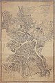
 Leningrad-1933.jpg 9,258 × 12,688; 38.92 MB
-
 Leningrad-aerofotogrammetrik.jpg 7,460 × 11,170; 14.79 MB
-
 Leningrad. LOC 79690374.jpg 10,844 × 15,396; 18.07 MB
-
 Leningrad. LOC 79690374.tif 10,844 × 15,396; 477.66 MB
-
 Leningrad1978.jpg 1,316 × 1,044; 223 KB
-
 Petrogradskaya side.jpg 1,067 × 806; 366 KB
-
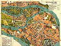
 Plan Leningrad 1927.jpg 1,518 × 1,600; 993 KB
-
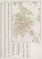
 Street map of Leningrad. LOC 78693185.jpg 10,068 × 13,483; 9.43 MB
-
 Street map of Leningrad. LOC 78693185.tif 10,068 × 13,483; 388.38 MB
-
 USSR map NO 36-1 -verso- Leningrad and Vicinity.jpg 3,368 × 3,308; 2.2 MB
-
 Районы Ленинграда на 1936 год.png 1,564 × 2,042; 331 KB
-
 Фрагмент плана Ленинграда, 1925.jpg 568 × 568; 513 KB
-
 Фрагмент плана Ленинграда, 1939.jpg 568 × 568; 517 KB


,_Corps_of_Engineers,_U.S._Army,_Washington_D.C._in_1953_(txu-oclc-6519747-no36-1).jpg)


