Category:Old maps of Medieval Iberia
This category is for old maps showing all or a large part of Medieval Iberia. See subcategories for smaller areas.
- "Old maps" means maps made over seventy (70) years ago.
| Where to categorize or find maps of Medieval Iberia made in the last 70 years: |
|---|
| Category:Maps of Medieval Iberia or its subcategories |
Español: Mapas de la Península Ibérica durante la Edad Media, del año 476 al 1492 d.C.
Français : Cartes de la péninsule ibérique au cours du Moyen-Âge, de 476 à 1492 apr. J-C.
Subcategories
This category has the following 6 subcategories, out of 6 total.
D
G
- Gallaecia Regnum (1634) (12 F)
- Gallaecia Regnum (1636) (7 F)
O
- Old maps of the Suebi (22 F)
P
- Ptolemy's 2nd European Map (56 F)
Media in category "Old maps of Medieval Iberia"
The following 57 files are in this category, out of 57 total.
-
 (Spruner-Menke, map 14) The Iberian peninsula 531-711.jpg 3,355 × 2,759; 2.18 MB
-
 España750.jpg 600 × 562; 224 KB
-
 Spain at about the begining of the IXth century (16404440729).jpg 1,696 × 1,232; 474 KB
-
 España814.jpg 335 × 275; 76 KB
-
 España910.jpg 826 × 640; 503 KB
-
 España1000.jpg 442 × 379; 150 KB
-
 España1037.jpg 826 × 640; 522 KB
-
 España1150.jpg 830 × 640; 526 KB
-
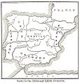
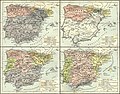
 Castilla 1210.png 600 × 643; 821 KB
-
 Spanish kingdoms 1360.jpg 1,151 × 863; 294 KB
-
 Senyeres a l'atlas de Benincasa (1473).jpg 395 × 369; 35 KB
-
 Senyera Macià Viladestes 1423.jpg 2,448 × 3,264; 3.62 MB
-
 Senyeres a l'atlas de Martines (1578).jpg 383 × 436; 44 KB
-
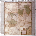 Map of the Kingdom of Aragon by Juan Bautista Labaña WDL7325.png 1,036 × 1,024; 2.26 MB
-
 Aragonia Regnum.jpg 2,824 × 2,268; 5.47 MB
-
 Le royaume d'Arragon.jpg 1,308 × 1,496; 2.81 MB
-
 CHAO(1849) Atlas Historico Geografico de España - Mapa 4 (756-1030).jpg 4,420 × 3,684; 7.53 MB
-
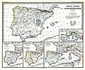
 FERNANLD(1898) SPAIN in the 14th. & 15th. Cent..jpg 891 × 928; 388 KB
-
 Carte du Portugal du Nord qui indique le Territoire de Sainte-Marie-de-Vendôme.jpeg 1,996 × 3,484; 483 KB
-
 CastillaLeon 1360.png 614 × 552; 702 KB
-
 Cataloniae principatus 1608.jpg 5,781 × 4,573; 9.95 MB
-
 Cronica de Alfonso III (1918) (14576519349).jpg 1,900 × 3,092; 1.03 MB
-
 Cronica de Alfonso III (1918) (14760814044).jpg 1,952 × 3,156; 1.24 MB
-
 D183- N° 348. Avance graduelle des Chrétiens en Espagne. - liv3-ch08.png 1,446 × 1,556; 291 KB
-
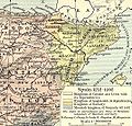
 D471- N° 238. Royaume d’Espagne au onzième siècle. -liv3-ch4.png 1,446 × 1,574; 189 KB
-
 España 1190.jpg 500 × 468; 213 KB
-
 España 1360.jpg 429 × 317; 138 KB
-
 España1212 a 1492.jpg 828 × 642; 530 KB
-
 EspañasigloXV.jpg 285 × 252; 61 KB
-
 FERNANLD(1898) SPAIN in the 12th. & 13th. Cent..jpg 881 × 926; 416 KB
-
 Hispania in Harley MS 3686 - 15th century.jpg 940 × 1,230; 401 KB
-
-

-
 Kingdom of Fez, Northern Morocco and Iberia.jpg 640 × 674; 214 KB
-
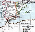
 Kingdom of Navarra 1250.jpg 533 × 512; 113 KB
-
 Leon 1030.png 620 × 654; 786 KB
-
 Mapa regne de valencia.jpg 300 × 423; 123 KB
-
 Marca Hispanica Longnon 806.png 1,448 × 1,404; 3.8 MB
-
 Medieval Spanish Universities.png 485 × 357; 419 KB
-
 Navaro-dum-1037.png 330 × 217; 154 KB
-

-
 Plànol Castell de Benidorm - Antonelli 1575.jpg 900 × 623; 232 KB
-
 Regni Valentiae Typus (Vorderseite).jpg 6,503 × 5,373; 12.16 MB
-
 Reino de leon.jpg 740 × 511; 416 KB
-
 Reino Valencia XVI.jpg 2,480 × 3,217; 4.03 MB
-
 Reyno de Galizia - kingdom of Galicia - reino de Galicia - Ojea.jpg 1,014 × 1,066; 1.1 MB
-
 Setge d'Alacant de 1708.jpg 597 × 473; 60 KB
-
 Shepherd-c-082-083.jpg 1,920 × 1,535; 832 KB
-
 Spain 1212-1492 (William R. Shepherd).jpg 859 × 672; 328 KB
-
 Spain 910-1492 (William R. Shepherd).jpg 1,721 × 1,355; 1.14 MB
-
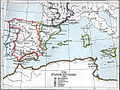
 Spain and Western North Africa 1360.jpg 726 × 666; 249 KB
-
 Spain in 1037 (William R. Shepherd).jpg 860 × 673; 300 KB
-
 Spain in 1150 (William R. Shepherd).jpg 857 × 677; 305 KB
-
 Spain in 910 (William R. Shepherd).jpg 852 × 673; 304 KB
-
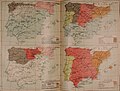
 Spruner-Menke Handatlas 1880 Karte 16.jpg 10,306 × 8,593; 22.62 MB
-
 Spruner-Menke Handatlas 1880 Karte 17.jpg 10,369 × 8,689; 22.23 MB
-
 Spruner-Menke Handatlas 1880 Karte 18.jpg 10,177 × 8,513; 21.68 MB
_The_Iberian_peninsula_531-711.jpg)

.jpg)


.jpg)

.jpg)


_Atlas_Historico_Geografico_de_Espa%C3%B1a_-_Mapa_4_(756-1030).jpg)
_SPAIN_in_the_14th._%26_15th._Cent..jpg)


_(14576519349).jpg)
_(14760814044).jpg)


_SPAIN_in_the_12th._%26_13th._Cent..jpg)

_(14597278448).jpg)


_e_a_Cr%C3%B3nica_de_1344.jpg)

.jpg)


.jpg)
.jpg)

.jpg)
.jpg)
.jpg)


