Category:Old maps of Melbourne
Media in category "Old maps of Melbourne"
The following 19 files are in this category, out of 19 total.
-

-

-
 270 of 'A School Geography' (11155890803).jpg 943 × 851; 192 KB
-

-

-

-

-

-

-

-

-
 County of Bourke 1866 zoom elgars special section zoom.jpg 802 × 803; 180 KB
-
 EB1911 Victoria (Australia).jpg 2,157 × 1,622; 1.85 MB
-
 Hoddle Map 1 1837.JPG 714 × 488; 53 KB
-
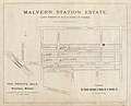 Malvern Station Estate.jpg 1,600 × 1,290; 377 KB
-
 Map of Melbourne and environs electric railway time zones.jpg 7,000 × 6,415; 13.87 MB
-
 Map of Melbourne and environs minimum railway or tramway time zones.jpg 7,000 × 6,422; 12.15 MB
-
 Map of Melbourne and suburbs showing time zones-present railways & tramways.jpg 7,000 × 6,395; 11.14 MB
-
 Meyers b11 s0446 b1.png 387 × 530; 117 KB
%27_(11254485683).jpg)

.jpg)
%27_(16590197305).jpg)
.jpg)
.jpg)
.jpg)
.jpg)
.jpg)
.jpg)


.jpg)


