Category:Old maps of Oppdal
Media in category "Old maps of Oppdal"
The following 11 files are in this category, out of 11 total.
-
 Kartblad 110- Carte over det Opdalske Compagnie District, 110, 1800.jpg 13,115 × 10,645; 12.78 MB
-
 Kartblad 131- Rids af det Opdalske Compagnie District, 1750.jpg 3,828 × 2,530; 1.14 MB
-
 Rektangelkart Opdal 42A, 1888.jpg 7,474 × 5,940; 10.84 MB
-
 Rektangelkart Opdal 42A, 1889 - 1.jpg 7,199 × 5,956; 8.55 MB
-
 Rektangelkart Opdal 42A, 1889 - 2.jpg 6,804 × 5,900; 8.69 MB
-
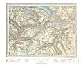
 Rektangelkart Opdal 42A, 1919.jpg 6,764 × 5,756; 8.59 MB
-
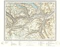
 Rektangelkart Opdal 42A, 1931.jpg 6,673 × 5,093; 7.29 MB
-
 Rektangelkart Opdal 42A, 1940.jpg 7,002 × 5,293; 7.69 MB
-
 Rektangelkart Oppdal 42A, 1956.jpg 6,683 × 5,257; 8.08 MB
-
 Rektangelkart Oppdal 42A, 1960.jpg 6,792 × 5,351; 7.69 MB
-
 Rektangelkart Oppdal 42A, 1964.jpg 6,552 × 5,119; 7.72 MB


