Category:Old maps of Osnabrück

Subcategories
This category has only the following subcategory.
Media in category "Old maps of Osnabrück"
The following 7 files are in this category, out of 7 total.
-
 Atlas Ortelius KB PPN369376781-042av-042br.jpg 3,000 × 2,194; 4.75 MB
-
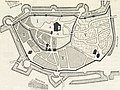
 Stadtplan von Osnabrück - Wenzel Hollar - 1633 cropped Kloster.jpg 545 × 518; 383 KB
-
 Stadtplan von Osnabrück - Wenzel Hollar - 1633.jpg 2,244 × 1,614; 1,005 KB
-
-
 Blaeu 1645 - Osnaburgensis Episcopatus.jpg 3,720 × 3,120; 1.32 MB
-
 Fürstbistum Osnabrück 1642.jpg 1,024 × 806; 349 KB
-
 Atlas ou Representation du Monde Universel t. 2. 1633 (110099597).jpg 16,909 × 12,127; 33.68 MB


.jpg)


.jpg)