Category:Old maps of Pakistan
Use the appropriate category for maps showing all or a large part of Pakistan. See subcategories for smaller areas:
| If the map shows | Category to use |
|---|---|
| Pakistan on a recently created map | Category:Maps of Pakistan or its subcategories |
| Pakistan on a map created more than 70 years ago | Category:Old maps of Pakistan or its subcategories |
| the history of Pakistan on a recently created map | Category:Maps of the history of Pakistan or its subcategories |
| the history of Pakistan on a map created more than 70 years ago | Category:Old maps of the history of Pakistan or its subcategories |
Subcategories
This category has the following 14 subcategories, out of 14 total.
B
K
O
P
- Ptolemy's 9th Asian Map (58 F)
- Old maps of Punjab, Pakistan (6 F)
S
- Old maps of Sindh (13 F)
Media in category "Old maps of Pakistan"
The following 10 files are in this category, out of 10 total.
-
 Admiralty Chart No 118 Delta of the Indus, Kediwari Mouth to Nirani Creek, Published 1897.jpg 16,147 × 10,874; 39.04 MB
-
 Afghanmap1893.JPG 647 × 487; 130 KB
-
 Chinese-Pak border map.png 1,199 × 877; 313 KB
-
 D389- Carte des chaînes du plateau d’Iran. -L2-Ch 1.png 1,508 × 1,376; 277 KB
-
 Hindoostan (20118721954) (cropped).jpg 1,594 × 669; 1.27 MB
-
 Hindoostan (20118721954).jpg 2,000 × 1,956; 3.66 MB
-
 Iran Pakistan boundary.png 845 × 1,132; 330 KB
-
 Map of the partition of British India.jpg 5,152 × 4,777; 2.71 MB
-
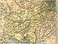
 Map, Country of the Sikhs, 1782.jpg 750 × 750; 246 KB
-
 Page 2 - CFL as shown on UN Map to Karachi Agreement 1949.JPG 918 × 797; 261 KB


_(cropped).jpg)
.jpg)


