Category:Old maps of Palestine
| Upload media | |||||
| Instance of | |||||
|---|---|---|---|---|---|
| Main subject | |||||
| |||||
Old maps of Palestine - in the Near East-Western Asia.
Use the appropriate category for maps showing all or a large part of Palestine. See subcategories for smaller areas:
| If the map shows | Category to use |
|---|---|
| Palestine on a recently created map | Category:Maps of Palestine or its subcategories |
| Palestine on a map created more than 70 years ago | Category:Old maps of Palestine or its subcategories |
| the history of Palestine on a recently created map | Category:Maps of the history of Palestine or its subcategories |
| the history of Palestine on a map created more than 70 years ago | Category:Old maps of the history of Palestine or its subcategories |
State of Palestine
[]
Deutsch: Karte Jerusalems:
Westjerusalem und Skopusberg
Waffenstillstandslinie von 1949
Altstadt
Arabische Viertel in Ostjerusalem
Stadtgrenze bis 1967
Jüdische Viertel in Ostjerusalem
Stadtgrenze
Jüdische Gebiete im Westjordanland
Arabische Gebiete im Westjordanland
English: Map of Jerusalem:
West Jerusalem and Mount Scopus
1949 armistice line
Old City, fully annexed by Israel
East Jerusalem, occupied Arab areas, annexed by Israel
Pre-1967 municipal boundary
East Jerusalem, Jewish colonies, annexed by Israel
Current Israeli extended boundary of the municipality and of the district of Jerusalem
West Bank, Jewish colonies in the new district of Samaria and Judea (zone C)
West Bank, occupied Arab areas (zone A, partially controled by the Palestinian National Authority)
Español: Mapa de Jerusalén:
Jerusalén Oeste y Monte Scopus
Frontera de armisticio de 1949
Ciudad Vieja
Jerusalén Este, áreas árabes
Frontera anterior a 1967
Jerusalén Este, áreas judías
Frontera de Jerusalén
Cisjordania, áreas judías
Cisjordania, áreas árabes
Français : Carte de Jérusalem :
Jérusalem-Ouest et Mont Scopus
Ligne d'armistice de 1949
Vieille ville, entièrement annexée par Israël
Jérusalem-Est, secteurs arabes occupés par Israël
Frontière municipale avant 1967
Jérusalem-Est, colonies juives annexées par Israël après 1967
Frontière actuelle d'extension israélienne de la municipalité et du district de Jérusalem
Cisjordanie, colonies juives dans le nouveau district israélien de Samarie et de Judée (zone C)
Cisjordanie, secteurs arabes occupés (zone A, partiellement contrôlée par l'Autorité nationale palestinienne)
Subcategories
This category has the following 22 subcategories, out of 22 total.
Pages in category "Old maps of Palestine"
This category contains only the following page.
Media in category "Old maps of Palestine"
The following 47 files are in this category, out of 47 total.
-
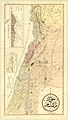
 Nazareth 1681.jpg 2,418 × 2,065; 2.15 MB
-
 1889 Arabic language map of Syria, Lebanon and Palestine.jpg 7,598 × 13,449; 12.07 MB
-
 105 of 'Buried Cities and Bible Countries' (11212909116).jpg 1,325 × 1,780; 570 KB
-

-

-

-

-
 8 of 'Echoes from Palestine ... With ... illustrations' (11160783806).jpg 1,499 × 2,406; 716 KB
-

-

-
 C+B-Syria-Map2-AccordingToAmarnaLetters.JPG 670 × 2,048; 503 KB
-
 Ca. 1850 manuscript map of the Holy Land.jpg 5,580 × 9,650; 6.31 MB
-

-
 Insularium Illustratum (Additional MS 15760, ff.58v-59r).jpeg 7,985 × 4,410; 38.45 MB
-
 Jordan, in Burckhardt's map of Syria and Holy Land.jpg 1,482 × 2,276; 253 KB
-
 Map of Jericho in 14c Farhi Bible by Elisha ben Avraham Crescas.jpg 700 × 752; 168 KB
-
 Map of Palestine (British Mandate) (FL45611035 3950409).jpg 5,094 × 3,498; 4.4 MB
-
 Modern Palestine (FL37128403 3904941).jpg 1,783 × 2,479; 2.05 MB
-
 Mount Lebanon Mutasarrifate in 1889.jpg 2,292 × 2,549; 1.07 MB
-
 Mutasarrifate of Jerusalem in 1889.jpg 2,795 × 2,854; 1.18 MB
-
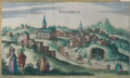
 Nazareth 1657.jpg 2,398 × 1,458; 1.55 MB
-
 Nazareth, by Jansson.png 2,326 × 1,388; 6.18 MB
-
 Ottoman map of the Mutasarrifate of Jerusalem, from 1882-83 (1300 AH).jpg 1,734 × 1,190; 263 KB
-
 Palaestina 01.jpg 5,842 × 8,035; 10.28 MB
-
 Palestina - compost pels Dr. Hans Fischer i Prof. Dr. H. Guthe - btv1b10104271d.jpg 10,824 × 13,829; 27.11 MB
-
 Palestina, sive Terrae Sanctae descriptio - btv1b550045719.jpg 7,150 × 5,896; 5.43 MB
-

-
 Palestinae sive Terra Sancta descriptio - btv1b55000219w.jpg 8,147 × 6,200; 5.18 MB
-
 Palestinae sive Terra Sancta descriptio - btv1b8490858h.jpg 8,772 × 6,262; 10.58 MB
-

-
 Palestinae sive terre sanctae descriptio - btv1b55005158f.jpg 8,010 × 5,627; 5.62 MB
-
 Palestinae sive Terre Sancte descriptio - btv1b55004945c.jpg 6,575 × 5,738; 4.21 MB
-
 Palestinae sive Terre. Sancte descriptio - btv1b53223666v.jpg 6,320 × 4,902; 6.2 MB
-
 Palestine - Dessiné par Pierre Tardive - btv1b8444399k.jpg 4,319 × 3,487; 2.65 MB
-

-

-

-
 Palestine and Trans-Jordan - Jerusalem - War Office - btv1b101042610.jpg 23,945 × 18,168; 77.65 MB
-
 Palestine and Transjordan - Haifa - War Office - btv1b10104262f.jpg 23,672 × 17,808; 65.39 MB
-

-

-

-
 Palestine Palestine ancienne - par Maurice Teissier - btv1b53066727r.jpg 12,155 × 14,512; 31.5 MB
-
 Palestine, Syrie-Cilicie - btv1b53197298r.jpg 8,678 × 10,534; 8.68 MB
-

-
 Tabula moderna Terræ Sanctæ. RRA 3= 72. Pièce 49.jpg 2,304 × 1,790; 800 KB
-


.jpg)
.jpg)
.jpg)
.jpg)
.jpg)
.jpg)
_(14778342914).jpg)


.jpeg)


_(FL45611035_3950409).jpg)
.jpg)


.jpg)


_(cropped).jpg)

_(14796308203).jpg)
_by_I._Leeser%27_(11032421696).jpg)