Category:Old maps of Panama from the Norman B. Leventhal Map Center
Media in category "Old maps of Panama from the Norman B. Leventhal Map Center"
The following 4 files are in this category, out of 4 total.
-
 Darien Nautical Chart 1737.jpg 6,704 × 5,460; 8.08 MB
-
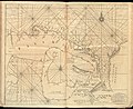
 Panama Nautical Chart 1775.jpg 7,855 × 5,959; 11.81 MB
-

-
 Plan of the town, road, and harbour of Chagre ; Plan of Porto Belo (18160894958).jpg 1,465 × 2,000; 2.2 MB


.jpg)
.jpg)