Category:Old maps of Pearl River
Media in category "Old maps of Pearl River"
The following 21 files are in this category, out of 21 total.
-
 Admiralty Chart No 1740 Canton River Sheet 3, Published 1930.jpg 10,928 × 16,090; 49.78 MB
-
 Admiralty Chart No 1741 Chu Kiang or Canton River Sheet 1, Published 1908, New Edition 1950.jpg 11,003 × 16,179; 35.48 MB
-
 Canton to Bocca Tigris.jpg 2,580 × 1,442; 1.69 MB
-
 Cantonriver.jpg 779 × 1,000; 100 KB
-

-
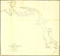 Chart of the Canton River.jpg 2,484 × 2,324; 264 KB
-
 Descripción del Río Tigris desde Canton hasta la Ysla de Lankeet. LOC 91680526.jpg 6,375 × 8,908; 5.76 MB
-
 Descripción del Río Tigris desde Canton hasta la Ysla de Lankeet. LOC 91680526.tif 6,375 × 8,908; 162.47 MB
-
 Map of Canton River.jpg 1,732 × 1,509; 266 KB
-
 Plan of the channel from Lintin to the Bocca Tigris LOC 88691800.jpg 5,082 × 7,444; 4.09 MB
-
 Plan of the channel from Lintin to the Bocca Tigris LOC 88691800.tif 5,082 × 7,444; 108.23 MB
-
 Plan of the channel from Lintin to the Bocca Tigris LOC 88691802.jpg 5,132 × 7,496; 4 MB
-
 Plan of the channel from Lintin to the Bocca Tigris LOC 88691802.tif 5,132 × 7,496; 110.06 MB
-
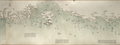
 Si Kiang or West River - Canton to Wuchow.jpg 3,574 × 1,016; 317 KB
-
 Survey of Canton River.jpg 2,143 × 1,507; 3.25 MB
-
 The Canton River.tif 4,035 × 2,230; 25.76 MB
-
 The Macao - Bocca Tigris - Canton approach.jpg 898 × 1,046; 773 KB
-
 This chart of the different passages leading to Macao Roads LOC 88691655.jpg 11,162 × 8,337; 8.85 MB
-
 This chart of the different passages leading to Macao Roads LOC 88691655.tif 11,162 × 8,337; 266.24 MB
-
 七省沿海圖-新安至陽江.png 2,748 × 1,024; 4.17 MB
-
 海不揚波圖(珠江口).jpg 4,592 × 2,584; 6.7 MB


