Category:Old maps of Pisa
Subcategories
This category has only the following subcategory.
Media in category "Old maps of Pisa"
The following 19 files are in this category, out of 19 total.
-
 Pisa (BM 1992,U.96).jpg 2,500 × 1,844; 1.43 MB
-
 Atlante Neroni - Pisa.jpg 2,220 × 1,495; 636 KB
-
 Baedeker Pisa.jpg 2,000 × 1,492; 4.75 MB
-
 Caffè dell'Ussero – 1775.jpg 2,304 × 2,373; 1.66 MB
-
 City map of Pisa, Italy, colored engraving, ca. 1730.jpg 1,600 × 1,316; 1.36 MB
-
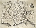 Cornelis Meyer, 1685, Carta di Pisa e la Foce dell'Arno.jpg 5,083 × 3,969; 14.02 MB
-

-
 Guide to Italy and Sicily (1911) (14763683984).jpg 3,096 × 2,812; 1.53 MB
-
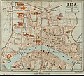
 Italy- a handbook for travellers. First Part (Nothern Italy) (1893) (14595037697).jpg 1,352 × 2,702; 1.03 MB
-
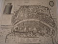
 Old map of Pisa.jpg 738 × 547; 200 KB
-
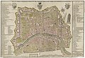
 Pianta della città di Pisa, fatta l'anno 1793 - btv1b8440577f.jpg 8,338 × 6,492; 10.69 MB
-

-
 Pisa Achille Soli c1590.jpg 940 × 717; 396 KB
-
 Pisa ancient map.jpg 2,592 × 1,944; 3.56 MB
-
 Pisa Map V century a.C..jpg 2,238 × 1,679; 2.51 MB
-
 Pisa Map XI century b.C..jpg 2,195 × 1,710; 1.71 MB
-
-
 UBBasel Map Pisa 1600 Kartenslg Mappe 97-20.tif 10,197 × 6,695, 2 pages; 195.34 MB
-
 Vallardi - Pisa e Livorno.jpg 4,097 × 6,485; 11.71 MB
.jpg)


_(14763683984).jpg)
_(1893)_(14595037697).jpg)


