Category:Old maps of Porto
English: Old maps of Oporto
Português: Mapas antigos do Porto
Use the appropriate category for maps showing all or a large part of Porto. See subcategories for smaller areas:
| If the map shows | Category to use |
|---|---|
| Porto on a recently created map | Category:Maps of Porto or its subcategories |
| Porto on a map created more than 70 years ago | Category:Old maps of Porto or its subcategories |
| the history of Porto on a recently created map | Category:Maps of the history of Porto or its subcategories |
| the history of Porto on a map created more than 70 years ago | Category:Old maps of the history of Porto or its subcategories |
Subcategories
This category has only the following subcategory.
1
- 19th-century maps of Porto (12 F)
Media in category "Old maps of Porto"
The following 28 files are in this category, out of 28 total.
-
 1833 map of Porto.jpg 9,245 × 7,744; 16.38 MB
-
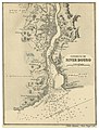 ROSSER(1869) p0523 RIVER DOURO.jpg 1,717 × 2,267; 2.33 MB
-
 1906 Porto.jpg 1,600 × 1,023; 684 KB
-
 285 of 'Aemstel's Oudheid, of gedenkwaardigheden van Amsterdam' (11045152936).jpg 5,050 × 3,772; 3.61 MB
-
 400 of '(British Battles on Land and Sea.)' (11170505333).jpg 1,925 × 1,612; 646 KB
-
 Admiralty Chart No 1507 Oporto to Isla Berlenga, Published 1936.jpg 11,274 × 17,585; 51.06 MB
-
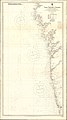 Admiralty Chart No 1752 Cape Villano to Oporto, Published 1922.jpg 11,345 × 20,293; 50.7 MB
-
 Admiralty Chart No 88 Plans on the Coast of Portugal, Published 1957.jpg 16,201 × 11,068; 42.05 MB
-
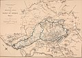
 Carta topografica das Linhas do Porto.jpg 2,572 × 1,804; 3.9 MB
-
 Cordon sanitaire Porto-1899.jpg 225 × 225; 16 KB
-
 Lot modules in Oporto.png 1,417 × 1,417; 3.68 MB
-
 Mapa da Linha de Leixoes - GazetaCF 1219 1938.jpg 832 × 529; 349 KB
-

-
 Planta da cidade do Porto 1903 Cortes.jpg 1,642 × 1,016; 372 KB
-
 Planta geografica da barra da cidade do Porto 1789.jpg 1,083 × 757; 528 KB
-
 Planta geográfica da barra da cidade do Porto 1789 (2).jpg 4,630 × 3,272; 3.07 MB
-
 Porto 1832.jpg 3,527 × 2,645; 3.04 MB
-
 Projectos para pontes ferroviarias sobre Douro - Diario Illustrado 263 1873.jpg 1,378 × 1,928; 1.33 MB
-
 Rede Complementar ao Norte do Mondego - GazetaCF 372 1903.jpg 962 × 860; 280 KB
-

-

-

-

-

-
 Royaumes d'Espagne et de Portugal 1780 Rigobert Bonne (detalle noroeste).jpg 1,318 × 1,066; 788 KB
-
 Spain and Portugal- handbook for travellers (1901) (14774381894).jpg 2,872 × 1,586; 1.64 MB
-
-
 Topographic map of Linhas do Porto.jpg 4,638 × 3,281; 2.86 MB

_p0523_RIVER_DOURO.jpg)

.jpg)
%27_(11170505333).jpg)


.jpg)


,_Arquivo_IGP,_CA-382.png)

.png)
,_Arquivo_IGP,_CA-384.png)
.jpg)
_(14774381894).jpg)
_(14577134078).jpg)
