Category:Old maps of Saint Petersburg Governorate
Subcategories
This category has only the following subcategory.
Media in category "Old maps of Saint Petersburg Governorate"
The following 65 files are in this category, out of 65 total.
-
Allgemeine Post- und Strassen-Karte des Russischen Reichs in Europa 04.jpg 5,576 × 4,668; 9.58 MB
-
Russland BV042519804.jpg 5,601 × 6,481; 3.15 MB
-
Россия. Кронштадт. План. 1901егг kronstadt-1901 e1.jpg 3,873 × 2,682; 2.77 MB
-
Alexeevka.jpg 349 × 149; 16 KB
-
Brockhaus and Efron Encyclopedic Dictionary b56 280-0.jpg 3,485 × 2,552; 3.3 MB
-
Gdov plan 1847.jpg 1,380 × 1,800; 587 KB
-
Gouvernement Sankt Petersburg BV004257108.jpg 13,323 × 9,499; 9.31 MB
-
Holopovitsy1831.jpg 542 × 217; 54 KB
-
Luga plan 1847.jpg 1,185 × 2,490; 650 KB
-
Map of European Russia in 1791 by Reilly 065.jpg 1,117 × 857; 441 KB
-
Map of Saint Peterburg Governorate 1770.jpg 6,925 × 5,552; 11.44 MB
-
Map of Saint Peterburg Governorate 1792 (small atlas).jpg 2,643 × 2,211; 789 KB
-
Map of Saint Peterburg Governorate 1796 (small atlas).jpg 2,882 × 2,421; 916 KB
-
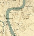
Map of vicinities of Staraya Ladoga in the first half of XIX century crop.jpg 2,100 × 1,698; 1.27 MB
-
Map of vicinities of Staraya Ladoga in the first half of XIX century crop2.jpg 2,311 × 2,462; 1.27 MB
-
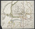
Map of vicinities of Staraya Ladoga in the first half of XIX century.jpg 5,892 × 4,823; 5.17 MB
-
Myza-Ivanovka oldmap.jpg 300 × 188; 96 KB
-
Novaya Ladoga plan 1847.jpg 1,335 × 2,643; 772 KB
-
Oranienbaum plan 1847.jpg 1,833 × 2,305; 1.09 MB
-
Pudost 1860.jpg 1,451 × 749; 219 KB
-
Russian Empire 1745 (Map II HQ).jpg 9,043 × 8,097; 10.39 MB
-
Russian Empire 1745 (Map II).jpg 2,144 × 1,892; 2.85 MB
-
RussianEmpireMap1800-02-SankpeterburgskayaProvince.jpg 4,000 × 3,230; 1.89 MB
-
Russland BV042515013.jpg 1,554 × 1,998; 507 KB
-
Russland BV042515020 (cropped).jpg 1,432 × 1,436; 398 KB
-
Russland BV042515024 (cropped).jpg 1,423 × 1,429; 372 KB
-
Russland BV042515044.jpg 1,538 × 2,010; 488 KB
-
Russland BV042516169.jpg 1,552 × 1,995; 486 KB
-
Russland BV042516175.jpg 1,551 × 2,018; 484 KB
-
Russland BV042516220.jpg 1,545 × 2,008; 506 KB
-
Russland BV042516266.jpg 1,571 × 2,002; 495 KB
-
Russland BV042516275.jpg 1,546 × 2,003; 490 KB
-
Russland BV042516308.jpg 1,540 × 1,999; 494 KB
-
Russland BV042519713 (cropped).jpg 1,435 × 1,197; 309 KB
-
Russland BV042519717 (cropped).jpg 1,439 × 1,217; 294 KB
-
Saint Petersburg Governorate 1820.jpg 4,912 × 4,727; 4.74 MB
-
Shlisselburg plan 1847.jpg 1,897 × 2,286; 959 KB
-
SP 1792.jpg 7,144 × 5,805; 5.93 MB
-
St. Peterburg and Finland Governorate map (1808).jpg 1,146 × 912; 238 KB
-
Stpetegub.jpg 3,485 × 2,552; 3.87 MB
-
SW part of Petrogradsky Uezd in 1916.png 2,460 × 1,564; 1.85 MB
-
Théatre de la Guerre en Finlande - 1742.jpg 3,271 × 2,874; 1.8 MB
-
Tsarskoye Selo plan 1847.jpg 1,986 × 2,476; 1.09 MB
-
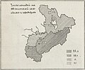
Volosti of the Uezd of St.Petersburg by 1890.png 472 × 820; 90 KB
-
Yamburg plan 1847.jpg 1,363 × 2,207; 530 KB
-
Zapolje1885.jpg 380 × 222; 27 KB
-
Гдовский уезд 1916 год.jpg 2,806 × 3,626; 6.02 MB
-
Карта Корельское княжество, 1725.jpg 1,600 × 2,010; 969 KB
-
Карта разграничения по Ништадтскому договору, 1722.jpg 1,600 × 1,389; 420 KB
-
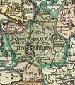
Новгородская провинция 1745.jpg 690 × 778; 564 KB
-
Новоладожский уезд 1916.jpg 3,705 × 3,345; 5.92 MB
-
Озерки 1886.jpg 1,096 × 684; 485 KB
-
Петергофский уезд 1916.jpg 1,881 × 1,625; 2.4 MB
-
Петроградский уезд 1916.jpg 1,368 × 2,040; 2.12 MB
-
Россия. План города Кронштадта 1913г,Козловский,СПб big kronstadt-1913 e1.jpg 3,204 × 2,046; 1.16 MB
-
Санкт-Петербургская, Ревельская и Рижская губернии. 1720-1727.jpg 4,597 × 5,358; 5.17 MB
-
Фрагмент карты Павловской слободы.jpg 2,833 × 2,927; 2.84 MB

