Category:Old maps of Santiago de Cuba
Media in category "Old maps of Santiago de Cuba"
The following 17 files are in this category, out of 17 total.
-
 Map of Santiago Bay WDL10079.png 1,370 × 1,024; 2.59 MB
-
 A Sketch of the harbour of St. Iago de Cuba. LOC 73691504.jpg 8,258 × 6,477; 7.36 MB
-
 A Sketch of the harbour of St. Iago de Cuba. LOC 73691504.tif 8,258 × 6,477; 153.03 MB
-

-

-
 Plan of St Jago de Cuba (1768).tif 3,093 × 3,675; 32.52 MB
-
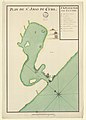
 Plan de Saint Jago - btv1b5970777j.jpg 6,568 × 4,752; 3.13 MB
-

-

-

-

-

-
 CLARK(1899) Cuba p543 - PLANO DE SANTIAGO DE CUBA.jpg 3,251 × 2,501; 3.76 MB
-
 Plan de St Jago de Cuba - btv1b5970778z.jpg 4,465 × 6,249; 2.7 MB
-
 Port de St Jago de Cube - btv1b5970779c.jpg 1,800 × 2,208; 439 KB
-
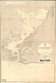 Admiralty Chart No 443 Santiago Harbour, Published 1901.jpg 8,357 × 12,194; 39.08 MB
-
 Plan Santiago de Cuba 1920.jpg 2,868 × 2,020; 2.28 MB


.jpg)
.jpg)
.jpg)
.jpg)
.jpg)
_Cuba_p543_-_PLANO_DE_SANTIAGO_DE_CUBA.jpg)


