Category:Old maps of Seneca County, Ohio
Subcategories
This category has the following 3 subcategories, out of 3 total.
S
Media in category "Old maps of Seneca County, Ohio"
The following 5 files are in this category, out of 5 total.
-
 Map of Seneca Co., Ohio LOC 2012592236.jpg 16,306 × 16,689; 36.08 MB
-
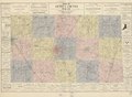
 Map of Seneca County, Ohio - 1890-91 LOC 2012592389.jpg 11,854 × 8,665; 15.99 MB
-
 Map of Seneca County, Ohio - 1890-91 LOC 2012592389.tif 11,854 × 8,665; 293.87 MB
-
 Map of Seneca County, Ohio LOC 2012592390.jpg 13,511 × 9,899; 19.32 MB
-
 Map of Seneca County, Ohio LOC 2012592390.tif 13,511 × 9,899; 382.65 MB


