Category:Old maps of Shirvan
Media in category "Old maps of Shirvan"
The following 22 files are in this category, out of 22 total.
-
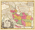
Jomann Imperium Periscum.jpg 1,992 × 1,700; 2.18 MB
-
Гербер Каспий 1728 (cropped).jpg 3,072 × 3,943; 2.28 MB
-
Карта Гербера - Лезгистан.gif 748 × 925; 31 KB
-
1730 Van Verden Map of the Caspian Sea - Geographicus - CaspienSea-vanverden-1721.jpg 2,310 × 3,500; 2.23 MB
-
Die Völker des Caucasus nach den Berichten der Reisebeschreiber.jpg 9,456 × 7,776; 6.79 MB
-
Armenia Azerbaijan Shirvan 1760.jpg 461 × 210; 36 KB
-
Atropatena.jpg 629 × 789; 251 KB
-
Chechen Island on a map of 1730.png 495 × 658; 797 KB
-
John Pinkerton. Map of Persia. 1818.E. Shirvan.jpg 469 × 511; 86 KB
-
John Senex. Kaspiska havet. 1742.jpg 850 × 685; 106 KB
-
Map Caucasus War (1809-1817) by Anosov (N).jpg 1,052 × 762; 338 KB
-
Moll, Herman. Caspian Sea, Terky, Derbent, Astracan. 1736.jpg 3,080 × 5,260; 2.92 MB
-
Rigobert Bonne. Perse. 1787 (E).jpg 571 × 456; 102 KB


