Category:Old maps of Sint Eustatius
Media in category "Old maps of Sint Eustatius"
The following 27 files are in this category, out of 27 total.
-
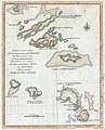 1781 Lodge Map of St. Bart, Anguilla, St. Martins, Leeward Islands, West Indies.JPG 1,200 × 1,488; 1.48 MB
-
 NL-HaNA 4.MIKO 339-groot.jpg 6,977 × 5,466; 2.94 MB
-
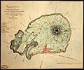 Carte Topographique de l'Ile Saint Eustache Samuel Fahlberg 1830.jpg 5,458 × 4,540; 18.71 MB
-
 Encyclopaedie van Nederlandsch West-Indië-Antilles part 1+2.gif 4,032 × 5,430; 9.37 MB
-
 From St. Christopher to Eustatius with Saba Island. (U. S. Hydrographic Chart. No. 369.) NYPL2020225.tiff 6,219 × 8,215, 2 pages; 146.23 MB
-
 Generale verzamelkaart der Nederlandsche Westindische bezittingen, KITLV 47D34.tiff 5,458 × 4,162; 65.02 MB
-
 Item 53095.jpg 600 × 343; 20 KB
-
 Item 53166.jpg 600 × 504; 38 KB
-

-

-

-
 Kaart van het eiland St. Eustatius Blanken ca.1800.jpg 600 × 327; 19 KB
-
 Map Fort Oranje, Sint Eustatius, National Archives Netherlands.jpg 4,000 × 3,000; 2.29 MB
-
 Map Sint Eustatius, Dutch National Archives (1).jpg 4,000 × 3,000; 3.2 MB
-
-

-
 On the birds of the islands of Aruba, Curaçao, and Bonaire (1893) (14563454738).jpg 3,302 × 2,398; 871 KB
-
 Overzicht met plaatsen van voormalige plantages - 20652588 - RCE.jpg 1,200 × 798; 316 KB
-
 Plaan van Sint Eustatius Alexander de Lavaux 1741.jpg 1,103 × 857; 204 KB
-
 Sint Eustatius Map 1915 B.jpg 1,472 × 1,504; 1.69 MB
-
 Sint Eustatius Map 1915.jpg 1,500 × 1,534; 379 KB
-
 St Martin, Saba, St Eustatius (map).jpeg 1,051 × 1,378; 161 KB
-
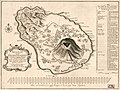
 St. Eustatia Topographically Drawn P.F. Martin ca. 1781.jpg 1,657 × 1,262; 604 KB
-
-

-
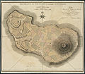 The island of St. Eustatius corruptly St. Eustatia (4586550799).jpg 2,000 × 1,754; 3.38 MB
-


,_NG-1064-10_(cropped).jpg)
,_NG-1064-10_(cropped2).jpg)
,_NG-1064-10.jpg)

.jpg)

_(14563454738).jpg)


.jpeg)


.jpg)
.jpg)
