Category:Old maps of Toronto Waterfront
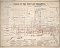
Media in category "Old maps of Toronto Waterfront"
The following 74 files are in this category, out of 74 total.
-
 1793 map of what is now Toronto harbour.jpg 668 × 441; 22 KB
-
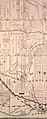
 1842 map of Toronto.jpg 412 × 316; 41 KB
-
 1851 map of Toronto and York Township.jpg 8,112 × 8,331; 6.17 MB
-
 1868.Gehle .Hassard.Sketch.WofTorontotoHumber-west-end.jpg 2,259 × 1,539; 2.5 MB
-
 1878 map of Toronto -a.jpg 4,409 × 4,602; 9.67 MB
-
 1878 map of Toronto -b.jpg 4,116 × 3,206; 6.04 MB
-
 1878 map of Toronto -c.jpg 4,126 × 3,402; 7.04 MB
-
-
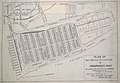
 1889 proposal for Ashbridge's Bay.jpg 1,920 × 1,238; 991 KB
-
 1892TorontoRailwayCompanyMap2.jpeg 5,616 × 1,873; 2.05 MB
-
 1893 proposed map of the Keating Channel.jpg 624 × 324; 26 KB
-
 18th Century map of Old York (Toronto).gif 349 × 214; 11 KB
-
 1906 Toronto Harbour map.png 2,324 × 811; 2.87 MB
-
 1937 map of development of Toronto's waterfront - G 3524 T61 G43 14 1937.jpeg 15,457 × 6,407; 64.2 MB
-
 An 1896 plan for Ashbridges Bay - Maps-r-151.jpg 1,920 × 1,292; 746 KB
-

-
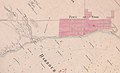
 Boundaries of newly incorporated Toronto -- 1834.jpg 391 × 200; 92 KB
-
 Charles W. Jefferys's map of lower Humber Toronto.jpg 4,608 × 3,456; 5.91 MB
-
 City of Toronto 1908 contour map (central) - G 3524 T61 C3 12 1908 R Central.jpeg 6,187 × 10,261; 25.66 MB
-
 City of Toronto 1908 contour map (east) - G 3524 T61 C3 12 1908 R East.jpeg 6,127 × 10,208; 16.97 MB
-
 City of Toronto 1908 contour map (west) - G 3524 T61 C3 12 1908 R West.jpeg 6,061 × 10,239; 15.25 MB
-
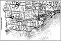
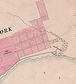
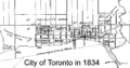 City of Toronto in 1834.gif 500 × 261; 13 KB
-

-
 Countour map of Toronto, east of Yonge.JPG 10,795 × 14,398; 29.57 MB
-
 Countour map of Toronto, west of Yonge.JPG 10,795 × 13,274; 30.57 MB
-
 Course of Bonar Creek, a tributary to Mimico Creek.jpg 738 × 367; 199 KB
-
 Enoch Turner's property, 1854.jpg 744 × 515; 104 KB
-
 Etobicoke waterfront 1788 showing Mimico Creek and Humber River.png 790 × 610; 149 KB
-

-
 Fort York and the lower reaches of Garrison Creek.jpg 544 × 535; 111 KB
-
-
 Fortifications of York, Upper Canada, when invaded in 1813.jpg 661 × 464; 200 KB
-

-
 Gother Mann plan or 'Torento', 1788.png 1,366 × 768; 584 KB
-
 Gustavus Nicolls 1816 plan of Fort York - e007140722LAC.jpg 7,348 × 6,360; 2.14 MB
-
-

-
 Jackson's Creek in Etobicoke, Ontario.jpg 1,082 × 1,432; 909 KB
-
 Lower course of Garrison Creek, Toronto, 1851.jpg 700 × 971; 176 KB
-
 Lower Reach of Upper Canada's Russell Creek -a.jpg 437 × 547; 116 KB
-
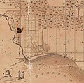
 Map of Ashbridges Bay and downtown Toronto, circa 1902.jpg 3,626 × 4,916; 12.6 MB
-
 Map of Gooderham and Worts' grain elevator in 1880.jpg 426 × 392; 82 KB
-
 Map of Old York (Toronto) 1788.jpg 710 × 473; 72 KB
-
 Map of Old York (Toronto) habrbour -- 1793.jpg 409 × 392; 42 KB
-
 Map of the attack on York, 1813, circa 1869.JPG 2,669 × 1,723; 338 KB
-

-
 Map of Toronto (50928651713).png 2,060 × 1,288; 3.42 MB
-
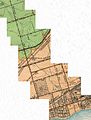
 Map of Toronto soil types, 1913.jpg 6,602 × 5,136; 6.81 MB
-
 Map of Toronto's Don Lands from around 1900.jpg 590 × 510; 132 KB
-
 Map of Toronto, 1842.jpg 14,409 × 12,786; 15.98 MB
-
 Map of Toronto, 1860.jpg 1,248 × 994; 203 KB
-
 Map of waterfront of York, Upper Canada, by Alexander Aitkin, 1793.png 1,366 × 680; 517 KB
-
 Old map of the beaches and small's pond.jpg 377 × 545; 185 KB
-
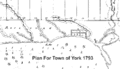 Plan for Town of York 1793.gif 500 × 287; 14 KB
-
 Plan of the fort at York, no. 24. E.W. Durnford, Sept 24, 1823..jpeg 3,088 × 2,978; 1.86 MB
-
-
 Plan of Toronto Harbour, Joseph Bouchette, 1792.png 1,267 × 955; 1.99 MB
-
 Plan of York Harbour (29652973174).jpg 1,920 × 1,208; 1.16 MB
-
 Plan of York Harbour, 1792, 1815.gif 400 × 247; 12 KB
-
 Plan of York, no. 24, See General Plan of the Canadies (y) E.W. Durnford, 1823-09-24.jpg 1,754 × 1,920; 1.13 MB
-

-

-
-
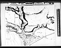
 South Etobicoke 1860.png 1,009 × 688; 527 KB
-
 Superior Creek, Etobicoke Ontario.jpg 1,016 × 722; 484 KB
-

-
-
 Toronto in 1858.jpg 1,920 × 1,541; 1.02 MB
-

-
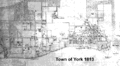 Town of York 1813.gif 500 × 273; 32 KB
-

-
 Town of York, Surveyor General's Office, York, 14th July 1830 - YP10-14-SR6469.jpg 8,114 × 2,385; 5.43 MB
-
 Upper Canada's Fort York and the lower reaches of Garrison Creek.jpg 820 × 772; 264 KB
-
 Watershed of Garrison Creek, 1878.jpg 1,148 × 2,904; 2.21 MB


.jpg)


.gif)


_-_G_3524_T61_C3_12_1908_R_Central.jpeg)
_-_G_3524_T61_C3_12_1908_R_East.jpeg)
_-_G_3524_T61_C3_12_1908_R_West.jpeg)


_during_War_of_1812.jpg)

_E.W._Durnford,_Sept_24,_1823_(rotated_49_degrees).jpg)

.png)


_1788.jpg)
_habrbour_--_1793.jpg)


.png)


.jpg)

_E.W._Durnford,_1823-09-24.jpg)
_E.W._Durnford,_Sept_24,_1823_(rotated_30_degrees_to_restore_true_north).jpg)
_E.W._Durnford,_Sept_24,_1823.jpg)


