Category:Old maps of Troy, New York
Media in category "Old maps of Troy, New York"
The following 17 files are in this category, out of 17 total.
-
-
 Clement's Art and Frame Shop (35629235315).jpg 4,074 × 2,988; 2.4 MB
-
 Damage by the Great Fire of Troy.jpg 294 × 300; 31 KB
-
 Fire 1820 Unrestored.png 2,634 × 3,418; 36.01 MB
-
 Fire 1820.png 2,066 × 2,645; 15.9 MB
-
 Fire 1854 Restored.png 831 × 1,877; 4.84 MB
-
 Fire 1854.png 1,018 × 2,015; 8.53 MB
-
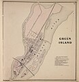 Green Island 1866.jpg 2,478 × 2,560; 758 KB
-
 Index Map City of Troy, N.Y. NYPL1584731.tiff 5,428 × 6,818; 105.88 MB
-
 Road map of the Albany-Troy district (10139232154).jpg 800 × 752; 200 KB
-
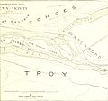
 The city of Troy and its vicinity in 1886, cityoftroyitsvic00weis 0 0012.jpg 1,149 × 1,621; 427 KB
-
 Troy NY map - 1877 - Bailey and Hazen.png 9,944 × 5,816; 83.85 MB
-
 Troy, N.Y. (2675049007).jpg 2,000 × 1,170; 2.01 MB
-
 Troy, N.Y. 1881. LOC 75694855.jpg 11,798 × 8,770; 17.41 MB
-
 Troy, N.Y. 1881. LOC 75694855.tif 11,798 × 8,770; 296.03 MB
-
 Troyandarea1881 (cropped for Union Station and Green Island Bridge).jpg 966 × 676; 206 KB
-
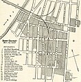
 Troyandarea1881.jpg 2,950 × 2,193; 1.43 MB
_(14781915364).jpg)
.jpg)


.jpg)


.jpg)

.jpg)
