Category:Old maps of Tula
Use the appropriate category for maps showing all or a large part of Tula. See subcategories for smaller areas:
| If the map shows | Category to use |
|---|---|
| Tula on a recently created map | Category:Maps of Tula or its subcategories |
| Tula on a map created more than 70 years ago | Category:Old maps of Tula or its subcategories |
| the history of Tula on a recently created map | Category:Maps of the history of Tula or its subcategories |
| the history of Tula on a map created more than 70 years ago | Category:Old maps of the history of Tula or its subcategories |
Media in category "Old maps of Tula"
The following 8 files are in this category, out of 8 total.
-
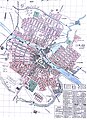 Map of Tula (1891).jpg 4,270 × 5,898; 4.91 MB
-
 Maps of Tula 1898.jpg 7,580 × 10,637; 18.47 MB
-
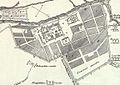 Крепости Тулы.jpg 574 × 406; 62 KB
-
 План города Тулы 1876.png 828 × 1,031; 1.1 MB
-
 План Тульских крепостей.png 4,026 × 5,794; 5.18 MB
-
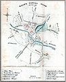 Тула в 1731 году.jpg 1,101 × 1,358; 273 KB
-
 Тула в XVIII веке.jpg 7,907 × 6,302; 5.97 MB
-
 Тульский засечный рубеж.jpg 605 × 716; 73 KB
.jpg)


