Category:Old maps of the Bay of Kotor
Media in category "Old maps of the Bay of Kotor"
The following 34 files are in this category, out of 34 total.
-
 Atlas factice des possessions de Venise et de l'Archipel - btv1b55010184g (069 of 127).jpg 4,339 × 3,367; 2.28 MB
-
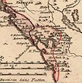
 Boka oldmap.gif 800 × 903; 101 KB
-
 Atlante Neroni - Golfo overo porto di Cattaro.jpg 2,314 × 1,495; 793 KB
-
 Coronelli.jpg 450 × 319; 38 KB
-
 Disegno Topografico Del Canale Di Cattaro.jpg 14,897 × 11,053; 32.46 MB
-
 Mappa delle Bocche di Cattaro- Kotor (Montenegro - ex dominio veneto 1420 -1797).jpg 2,304 × 1,728; 676 KB
-
 Atlante Veneto Volume 1 118.jpg 9,817 × 6,521; 8.9 MB
-
 Map of the Gulf of Catarro WDL472.png 1,409 × 1,024; 2.04 MB
-
 Plano del Golfo de Catarro. LOC 90683810.jpg 4,505 × 3,274; 1.24 MB
-
 Plano del Golfo de Catarro. LOC 90683810.tif 4,505 × 3,274; 42.2 MB
-

-

-
 Carte des Bouches de Cattaro (34167570760).jpg 10,790 × 6,776; 44.38 MB
-
 Le Tour du monde-01-p077.jpg 1,242 × 830; 387 KB
-
 Bay of Kotor map 1862.jpg 820 × 825; 500 KB
-
 Mouths of Cattaro.jpg 799 × 670; 142 KB
-

-
 Admiralty Chart No 2701 Gulf of Cattaro (Kotor) to Corfu, Published 1878.jpg 8,296 × 12,227; 12.19 MB
-
 Aufstand der Krivosije 1882 im Orjen.jpg 6,192 × 5,231; 6.34 MB
-
-

-

-
 Fuhrer durch Dalmatien 1899 (152908241).jpg 4,581 × 3,719; 10.49 MB
-
 Kassner Das Regenreichste Gebiet Europas 1904.jpg 2,059 × 2,714; 1.56 MB
-
 Russian-language history map of the Bay of Kotor.jpg 1,483 × 1,643; 285 KB
-
 Montenegro BV042770384.jpg 3,747 × 2,598; 2.01 MB
-
 Carta geografica in rilievo del montenegro, 1917, 04 bocche di cattaro.JPG 3,456 × 2,304; 5.63 MB
-
 Cattaro - 36-42.jpg 3,731 × 4,986; 1.88 MB
-
 Cattaro Bay, site of the Cattaro Mutiny 1918 (49940630586).jpg 1,620 × 1,624; 2.88 MB
-
 Cattaro Ragusa von Reilly 1789.jpg 640 × 649; 238 KB
-
 Cattaro-ships-positions-feb-1918 EN.jpg 2,982 × 1,998; 1.26 MB
-
 Cattaro. NYPL1227035.tiff 5,195 × 4,360; 43.85 MB
-
 Montenegro BV043564189.jpg 6,453 × 5,178; 6.15 MB
-
 Ottův slovník naučný - 19 Černá Hora a Boka Kotorská.jpg 2,372 × 1,947; 3.03 MB
.jpg)


.jpg)


.jpg)


_to_Malaluka_Bay_and_approaches_to_Cattaro_(Kotor,_Montenegro),_Published_1878.jpg)
_to_Corfu,_Published_1878.jpg)

.jpg)
.jpg)
.jpg)
.jpg)


.jpg)


