Category:Old maps of the Docks of London
Media in category "Old maps of the Docks of London"
The following 44 files are in this category, out of 44 total.
-
 103 of 'The Thames and its Docks- a lecture. (With plans.)' (11119101196).jpg 3,176 × 2,388; 1.04 MB
-
 105 of 'The Thames and its Docks- a lecture. (With plans.)' (11119211404).jpg 3,084 × 2,417; 984 KB
-
 107 of 'The Thames and its Docks- a lecture. (With plans.)' (11118671615).jpg 3,200 × 2,406; 1.01 MB
-
 1830londonSE.png 7,500 × 7,500; 97.55 MB
-
 (A) EDWARD OGLES' PLAN.jpg 3,189 × 2,333; 3.06 MB
-
 (B) THE MERCHANTS PLAN OF LONDON DOCKS.jpg 3,033 × 2,135; 3.09 MB
-
 (C) CORPORATION SCHEME.jpg 2,933 × 2,087; 2.5 MB
-
 (D) WYATT'S PLAN.jpg 2,927 × 2,167; 2.77 MB
-
 (E) SOUTHWARK SCHEME.jpg 3,077 × 2,137; 2.77 MB
-
 (F) RALPH WALKERS PLAN OF WET DOCKS IN WAPPING.jpg 3,145 × 2,239; 3.39 MB
-
 (G) SPENCE'S PLAN.jpg 2,973 × 2,213; 2.72 MB
-
 (H) REVELEYS PLAN (1).jpg 3,049 × 2,279; 2.75 MB
-
 (I) REVELEY'S PLAN (2).jpg 3,091 × 2,347; 2.84 MB
-
 (J) REVELEY'S PLAN (3).jpg 2,963 × 2,065; 2.6 MB
-
 (K) REVELEY'S PLAN (4).jpg 3,051 × 2,399; 2.99 MB
-
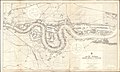
 (L) THE RIVER THAMES SHEWING ALL DOCKS OF LONDON WITH THE EXTENSIONS IN PROGRESS.jpg 4,709 × 1,691; 3.93 MB
-
 99 of 'The Thames and its Docks- a lecture. (With plans.)' (11119790694).jpg 3,100 × 2,435; 1 MB
-
 A late survey - (la Tamise en aval du pont de Londres) - btv1b53010417k.jpg 9,038 × 6,615; 7.16 MB
-
 A new and correct chart from the Isle of Dogs, to Prittlewell, and the Nore RMG F8050.tiff 4,989 × 3,597; 51.34 MB
-
 Admiralty Chart No 3191 River Thames Woolwich to Erith, Published 1901.jpg 16,428 × 11,293; 56.05 MB
-
 Admiralty Chart No 3337 River Thames London Bridge to Woolwich, Published 1903.jpg 18,805 × 11,282; 88.37 MB
-
 Blackfriars Theatres, London - location map.png 1,097 × 1,612; 638 KB
-

-
 Extract from OS 1 to 1250 map of London (TQ3280SE) 1952.png 626 × 446; 651 KB
-
 Fenner's Wharf and Millwall Outer Dock Ordinance Survey 1940s-1960s.png 1,289 × 521; 819 KB
-
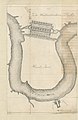
 Greenland Dock 1763.jpg 969 × 920; 178 KB
-
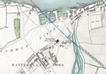
 Horwood Blackwall.jpg 673 × 624; 306 KB
-
-
 Isle of dogs 1899.jpg 486 × 600; 183 KB
-
 Isle of Dogs as shown in John Rocque's map of London, 1747.JPG 2,056 × 3,088; 4.68 MB
-

-
 London Western Docks Admiralty Chart No 3337 1903.jpg 3,252 × 1,812; 3.47 MB
-
 Mouth of the River Heathwall.png 1,251 × 877; 2.24 MB
-

-

-
 Plan of London Docks by Henry Palmer 1831.JPG 804 × 634; 213 KB
-
 Poplar & Blackwall 1703.jpg 3,145 × 2,006; 1.24 MB
-
 Port Of London 1837.jpg 1,752 × 1,168; 536 KB
-
 ReveleyThamesscheme1796.JPG 700 × 397; 59 KB
-

-

-
 Surrey Commercial Docks Admiralty Chart No 3337 1903.jpg 2,736 × 2,949; 4.69 MB
-
 Thames river 1882.jpg 4,499 × 1,217; 982 KB
-
 Thames wharf map 1905 London Bridge to Limehouse.jpg 4,096 × 2,304; 860 KB
%27_(11119101196).jpg)
%27_(11119211404).jpg)
%27_(11118671615).jpg)

_EDWARD_OGLES%27_PLAN.jpg)
_THE_MERCHANTS_PLAN_OF_LONDON_DOCKS.jpg)
_CORPORATION_SCHEME.jpg)
_WYATT%27S_PLAN.jpg)
_SOUTHWARK_SCHEME.jpg)
_RALPH_WALKERS_PLAN_OF_WET_DOCKS_IN_WAPPING.jpg)
_SPENCE%27S_PLAN.jpg)
_REVELEYS_PLAN_(1).jpg)
_REVELEY%27S_PLAN_(2).jpg)
_REVELEY%27S_PLAN_(3).jpg)
_REVELEY%27S_PLAN_(4).jpg)
%27_(11119790694).jpg)
_-_btv1b53010417k.jpg)


.jpg)
_1952.png)


.jpg)


.jpg)


_THE_RIVER_THAMES_SHEWING_ALL_DOCKS_OF_LONDON_WITH_THE_EXTENSIONS_IN_PROGRESS.jpg)