Category:Old maps of the Federated States of Micronesia
Media in category "Old maps of the Federated States of Micronesia"
The following 24 files are in this category, out of 24 total.
-
 114 karolinen-marshall-marianen-und-palau-inseln (1905).png 1,763 × 1,154; 1.33 MB
-
 Pelew islands and adjacent seas.png 1,500 × 814; 2.41 MB
-
 1886 Spanish nautical map of Elato and Lamotrek.jpg 3,535 × 1,733; 429 KB
-
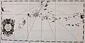
 1886 Spanish nautical map of Federated States of Micronesia islands.jpg 4,584 × 5,412; 1.63 MB
-
 1886 Spanish nautical map of Olimarao.jpg 995 × 1,179; 108 KB
-
 1886 Spanish nautical map of Pikelot.jpg 867 × 1,171; 89 KB
-
 1886 Spanish nautical map of West Fayu.jpg 1,711 × 1,183; 159 KB
-
 1886 Spanish nautical map of Woleai Atoll.jpg 3,543 × 2,141; 716 KB
-
 Die Deutschen Besitzungen im Stillen Ocean 11657068.jpg 13,359 × 10,744; 45.89 MB
-
 Übersicht Der Deutschen Besitzungen im Stillen Ozean-Nauru.png 2,518 × 2,538; 4.49 MB
-

-

-
 Carta general de las islas Palaos, Marianas y Carolinas (détail).tif 2,768 × 1,471; 11.68 MB
-
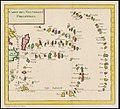 Carte des Nouvelles Philippines.jpg 1,089 × 1,000; 969 KB
-
 Ifaluk.jpg 745 × 755; 110 KB
-
 Kusae - auf grundlage der brit. u. deutsch. seekarte LOC 2008621655.jpg 6,346 × 5,459; 5.09 MB
-
 Kusae - auf grundlage der brit. u. deutsch. seekarte LOC 2008621655.tif 6,346 × 5,459; 99.11 MB
-
-
 Map of Ulithi Atoll.jpg 569 × 533; 47 KB
-
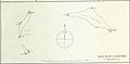
 Mokil.jpg 829 × 1,139; 158 KB
-
 Pingelap.jpg 825 × 1,137; 307 KB
-
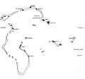
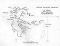 Ulithi Islands.png 1,650 × 1,263; 1.25 MB
-
 Ulithi.jpg 829 × 626; 90 KB
-
 Unternehmung gegen Nankiop.jpg 1,424 × 1,230; 275 KB
.png)


_Straits,_for_the_purpose_of_exploring_a_north-east_passage_(microform)_-_undertaken_in_the_years_1815-1818,_at_the_expense_of_His_Highness_(20442490628).jpg)


_(14578378369).jpg)


